Waterway information

Kind:
Inland
Driving areas:
🇵🇱 Poland
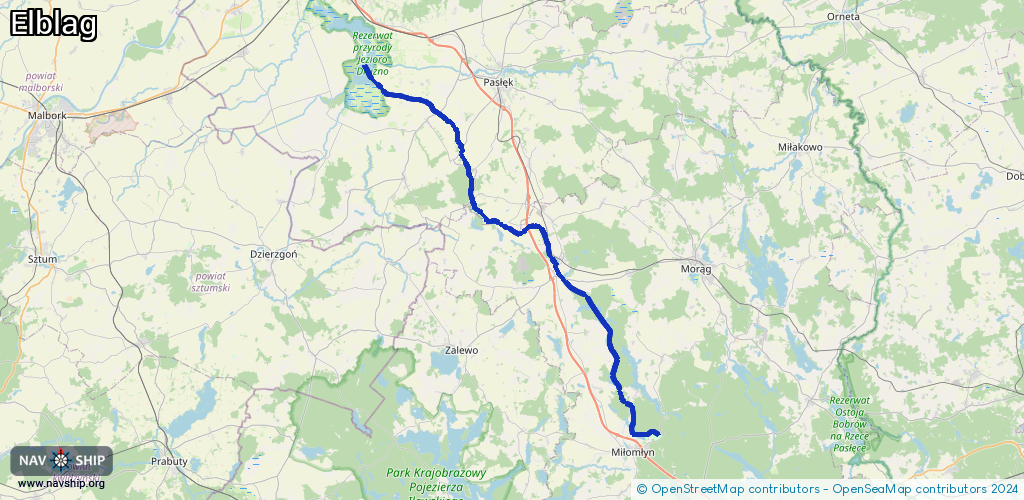
Length:
50.3 km¹
¹River kilometers or bank length recorded in NavShip, including river arms and harbor entrances.
Availability:
Completely recorded
Recent Update: 05.04.2025²
² This date indicates when an adjustment last took place in the course of the body of water
Recorded:
Locks: 5
Harbours / marinas: 1
Bridges: 2
Berths: 0
Slipways: 0
Fuelstations: 0
Route:
Please wait, loading route graphic...
Request waterway overview map with symbol legend here (Link).
Information about data associated with this body of water (8 available):
Data by OpenSeaMap (c) OSM contributors, www.openseamap.org
| # | Kind | Coordinates | Name | Information |
|---|---|---|---|---|
| 1 | Marina | 53.80136,19.84215 | 2020-07-23T08:51:08Z | Port |
| 2 | Bridge | 53.97443,19.61788 | 3.5 | Clearance height: 2017-01-29T15:34:11Z m Maximum passage width: 4.3 m fixed |
| 3 | Bridge | 54.03733,19.57404 | 9.2 | Clearance height: 2017-01-29T16:13:10Z m Maximum passage width: 4.3 m fixed |
| 4 | Lock | 53.97951,19.61864 | Unknown | |
| 5 | Lock | 53.99665,19.61169 | Pochylnia | |
| 6 | Lock | 54.0184,19.59934 | Krasin | |
| 7 | Lock | 54.03409,19.58109 | Jelonki | |
| 8 | Lock | 54.04557,19.56 | Unknown |