Waterway information

Kind:
Inland
Driving areas:
🇦🇷 Argentina
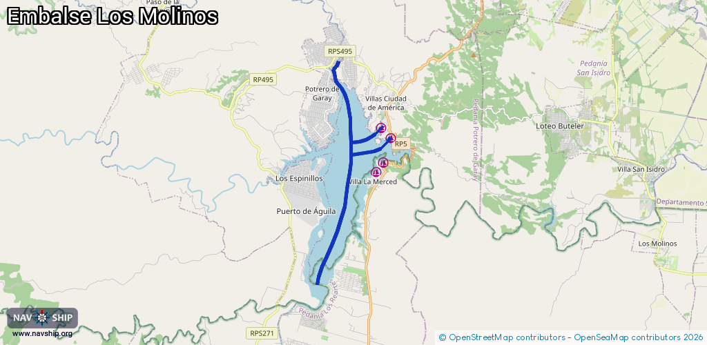
Length:
14.9 km¹
¹River kilometers or bank length recorded in NavShip, including river arms and harbor entrances.
Availability:
Completely recorded
Recent Update: 01.04.2025²
² This date indicates when an adjustment last took place in the course of the body of water
Recorded:
Locks: 0
Harbours / marinas: 4
Bridges: 0
Berths: 0
Slipways: 0
Fuelstations: 0
Route:
Please wait, loading route graphic...
Request waterway overview map with symbol legend here (Link).
Information about data associated with this body of water (4 available):
Data by OpenSeaMap (c) OSM contributors, www.openseamap.org
| # | Kind | Coordinates | Name | Information |
|---|---|---|---|---|
| 1 | Marina | -31.80577,-64.5171 | 2020-08-31T00:39:04Z | |
| 2 | Marina | -31.82436,-64.51974 | 2020-12-13T20:28:49Z | |
| 3 | Marina | -31.82043,-64.51609 | 2020-11-16T23:08:28Z | |
| 4 | Marina | -31.80997,-64.51247 | 2020-08-31T00:39:04Z |