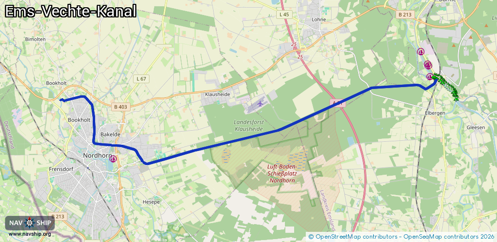
Waterway information

Kind:
Inland
Driving areas:
🇩🇪 Germany
Length:
21.3 km¹
¹River kilometers or bank length recorded in NavShip, including river arms and harbor entrances.
Availability:
Completely recorded
Recent Update: 25.02.2026²
² This date indicates when an adjustment last took place in the course of the body of water
Recorded:
Locks: 0
Harbours / marinas: 0
Bridges: 8
Berths: 0
Slipways: 0
Fuelstations: 0
Route:
Please wait, loading route graphic...
Request waterway overview map with symbol legend here (Link).
Information about data associated with this body of water (8 available):
Data by OpenSeaMap (c) OSM contributors, www.openseamap.org
| # | Kind | Coordinates | Name | Information |
|---|---|---|---|---|
| 1 | Bridge | 52.4649,7.30386 | Unknown | Clearance height: 2014-05-01T15:35:17Z m fixed |
| 2 | Bridge | 52.46483,7.26294 | Unknown | Clearance height: 2014-04-24T16:34:09Z m fixed |
| 3 | Bridge | 52.45856,7.24058 | Unknown | Clearance height: 2014-04-24T16:34:09Z m fixed |
| 4 | Bridge | 52.44952,7.2083 | Unknown | Clearance height: 2014-05-01T15:35:17Z m fixed |
| 5 | Bridge | 52.43408,7.10155 | Unknown | Clearance height: 2025-11-17T09:43:40Z m Movable bridge (e.g. lifting bridge or drawbridge) opening May 01-Oct 31: Mo-Su 10:00-11:00,14:30-15:30 |
| 6 | Bridge | 52.4342,7.10143 | Unknown | Clearance height: 2014-05-01T15:35:19Z m Maximum passage width: 3.5 m fixed |
| 7 | Bridge | 52.43994,7.08903 | Unknown | Clearance height: 2014-05-01T15:35:19Z m Maximum passage width: 3.5 m fixed |
| 8 | Bridge | 52.44026,7.08387 | Unknown | Clearance height: 2014-04-24T16:46:53Z m Maximum passage width: 1.4 m fixed |