Waterway information

Kind:
Lower
Driving areas:
🇦🇹 Austria
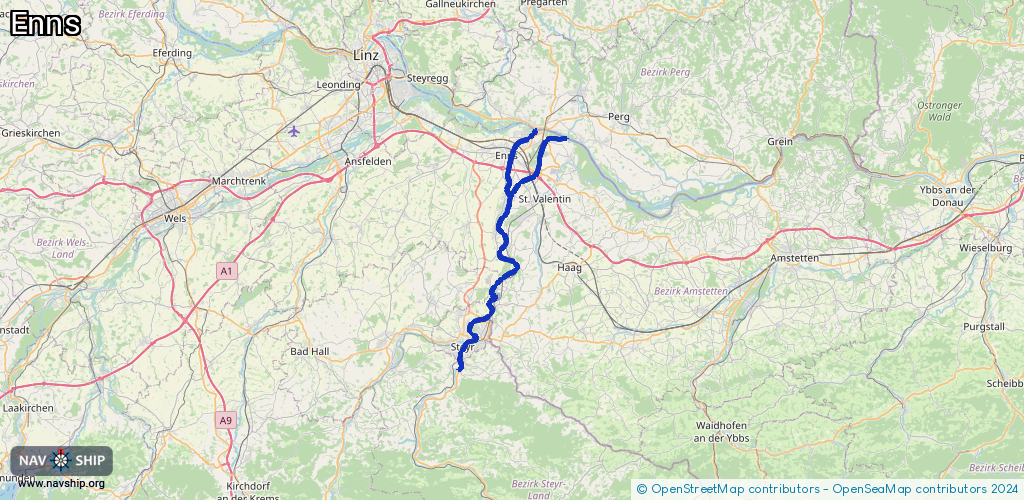
Length:
42.2 km¹
¹River kilometers or bank length recorded in NavShip, including river arms and harbor entrances.
Availability:
Completely recorded
Recent Update: 29.07.2024²
² This date indicates when an adjustment last took place in the course of the body of water
Recorded:
Locks: 1
Harbours / marinas: 2
Bridges: 0
Berths: 0
Slipways: 1
Fuelstations: 0
Route:
Please wait, loading route graphic...
Request waterway overview map with symbol legend here (Link).
Information about data associated with this body of water (4 available):
Data by OpenSeaMap (c) OSM contributors, www.openseamap.org
| # | Kind | Coordinates | Name | Information |
|---|---|---|---|---|
| 1 | Marina | 48.06298,14.4413 | 2025-07-08T08:29:40Z | Segelclub Seeadler |
| 2 | Marina | 48.15559,14.47288 | 2025-08-22T14:08:52Z | |
| 3 | Slipway | 48.09975,14.46611 | small_craft_facility | 2018-09-09T15:15:17Z |
| 4 | Lock | 48.22023,14.48822 | Enns |