Waterway information

Kind:
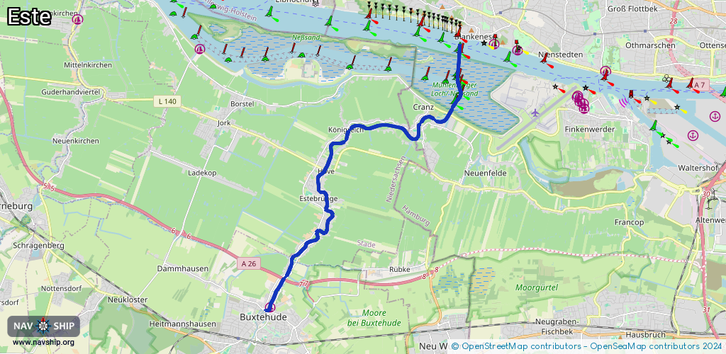
Sea
Driving areas:
🇩🇪 Germany
Length:
14.3 km¹
¹River kilometers or bank length recorded in NavShip, including river arms and harbor entrances.
Availability:
Completely recorded
Recent Update: 03.10.2025²
² This date indicates when an adjustment last took place in the course of the body of water
Recorded:
Locks: 0
Harbours / marinas: 1
Bridges: 4
Berths: 0
Slipways: 2
Fuelstations: 0
Route:
Please wait, loading route graphic...
Request waterway overview map with symbol legend here (Link).
Information about data associated with this body of water (7 available):
Data by OpenSeaMap (c) OSM contributors, www.openseamap.org
| # | Kind | Coordinates | Name | Information |
|---|---|---|---|---|
| 1 | Marina | 53.47939,9.70372 | 2022-04-24T17:54:04Z | Buxtehuder Wassersportverein Hansa e.V. |
| 2 | Bridge | 53.53512,9.79026 | Unknown | Clearance height: 2025-12-09T10:51:20Z m Movable bridge (e.g. lifting bridge or drawbridge) bascule Mo-Su 06:00-22:00 |
| 3 | Bridge | 53.53297,9.77653 | Unknown | Clearance height: 2025-12-09T10:51:20Z m Movable bridge (e.g. lifting bridge or drawbridge) retractable Mo-Su 06:00-22:00 |
| 4 | Bridge | 53.51905,9.72994 | Unknown | Clearance height: 2025-10-22T14:59:08Z m Movable bridge (e.g. lifting bridge or drawbridge) bascule |
| 5 | Bridge | 53.51081,9.73071 | Unknown | Clearance height: 2022-04-24T16:05:52Z m Movable bridge (e.g. lifting bridge or drawbridge) swing |
| 6 | Slipway | 53.53501,9.79217 | small_craft_facility | 2018-07-08T21:01:06Z |
| 7 | Slipway | 53.47956,9.70372 | small_craft_facility | 2022-04-24T17:54:04Z |