Waterway information

Kind:
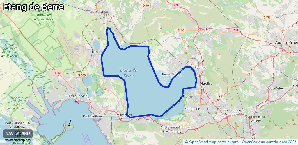
Lake
Driving areas:
🇫🇷 France🌊 Sea Mediterranean
Length:
66.7 km¹
¹River kilometers or bank length recorded in NavShip, including river arms and harbor entrances.
Availability:
Completely recorded
Recent Update: 05.07.2023²
² This date indicates when an adjustment last took place in the course of the body of water
Recorded:
Locks: 0
Harbours / marinas: 6
Bridges: 0
Berths: 0
Slipways: 1
Fuelstations: 0
Route:
Please wait, loading route graphic...
Request waterway overview map with symbol legend here (Link).
Information about data associated with this body of water (7 available):
Data by OpenSeaMap (c) OSM contributors, www.openseamap.org
| # | Kind | Coordinates | Name | Information |
|---|---|---|---|---|
| 1 | Marina | 43.52655,5.07953 | 2025-08-10T17:19:37Z | Port de plaisance Beau Rivage |
| 2 | Marina | 43.54498,5.03266 | 2022-04-06T11:18:29Z | Port de plaisance Notre-Dame +33 4 90 50 92 07 |
| 3 | Marina | 43.47104,5.16819 | 2022-04-22T13:57:12Z | Port Albert Samson |
| 4 | Marina | 43.40158,5.11949 | 2017-03-28T14:54:22Z | Port à sec |
| 5 | Marina | 43.40318,5.11879 | 2022-08-08T09:23:59Z | Port de la Mède |
| 6 | Marina | 43.40107,5.06112 | 2022-06-01T14:32:40Z | |
| 7 | Slipway | 43.49847,4.99879 | small_craft_facility | 2017-03-28T14:15:42Z |