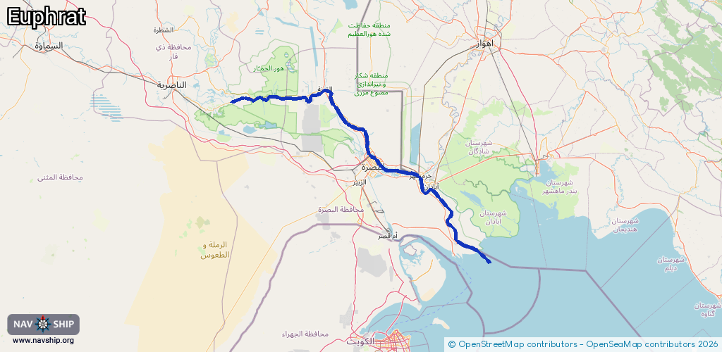
Waterway information

Kind:
Inland
Driving areas:
Other areas
Length:
286.1 km¹
¹River kilometers or bank length recorded in NavShip, including river arms and harbor entrances.
Availability:
Completely recorded
Recent Update: 20.11.2023²
² This date indicates when an adjustment last took place in the course of the body of water
Recorded:
Locks: 0
Harbours / marinas: 2
Bridges: 0
Berths: 0
Slipways: 2
Fuelstations: 2
Route:
Please wait, loading route graphic...
Request waterway overview map with symbol legend here (Link).
Information about data associated with this body of water (6 available):
Data by OpenSeaMap (c) OSM contributors, www.openseamap.org
| # | Kind | Coordinates | Name | Information |
|---|---|---|---|---|
| 1 | Marina | 30.44089,48.14789 | 2025-11-16T14:02:21Z | بندر و گمرک خرمشهر |
| 2 | Marina | 30.42929,48.16551 | 2025-11-16T14:02:21Z | پایانه مسافربری خلیج فارس |
| 3 | Slipway | 30.44138,48.14375 | Unknown | 2021-05-12T10:39:01Z |
| 4 | Slipway | 30.42933,48.16221 | Unknown | 2018-05-26T16:21:17Z |
| 5 | Fuel station | 30.55121,47.81325 | 2023-11-26T12:15:16Z | |
| 6 | Fuel station | 30.54899,47.81705 | 2023-11-26T12:15:16Z |