Waterway information

Kind:
Inland
Driving areas:
🌊 Atlantic Ocean🇬🇧 United Kingdom
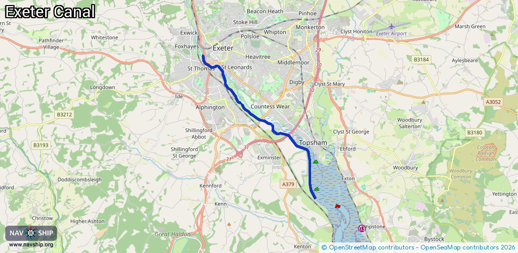
Length:
9.9 km¹
¹River kilometers or bank length recorded in NavShip, including river arms and harbor entrances.
Availability:
Completely recorded
Recent Update: 17.02.2019²
² This date indicates when an adjustment last took place in the course of the body of water
Recorded:
Locks: 2
Harbours / marinas: 0
Bridges: 2
Berths: 0
Slipways: 0
Fuelstations: 0
Route:
Please wait, loading route graphic...
Request waterway overview map with symbol legend here (Link).
Information about data associated with this body of water (4 available):
Data by OpenSeaMap (c) OSM contributors, www.openseamap.org
| # | Kind | Coordinates | Name | Information |
|---|---|---|---|---|
| 1 | Bridge | 50.66499,-3.4677 | Unknown | Clearance height: 2025-05-31T12:08:44Z m |
| 2 | Bridge | 50.66463,-3.46756 | Unknown | Clearance height: 2025-05-31T12:07:32Z m |
| 3 | Lock | 50.70055,-3.51353 | Unknown | |
| 4 | Lock | 50.66485,-3.46762 | Unknown |