Waterway information

Kind:
Inland
Driving areas:
🌊 Atlantic Ocean🇫🇷 France
Length:
8.3 km¹
¹River kilometers or bank length recorded in NavShip, including river arms and harbor entrances.
Availability:
Completely recorded
Recent Update: 25.07.2023²
² This date indicates when an adjustment last took place in the course of the body of water
Recorded:
Locks: 0
Harbours / marinas: 2
Bridges: 0
Berths: 0
Slipways: 4
Fuelstations: 0
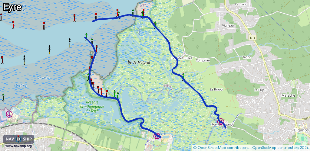
Route:
Please wait, loading route graphic...
Request waterway overview map with symbol legend here (Link).
Information about data associated with this body of water (6 available):
Data by OpenSeaMap (c) OSM contributors, www.openseamap.org
| # | Kind | Coordinates | Name | Information |
|---|---|---|---|---|
| 1 | Marina | 44.64077,-1.0176 | 2021-10-28T13:04:12Z | Port du Teich |
| 2 | Marina | 44.64381,-0.99956 | 2023-02-19T21:40:11Z | Port de Biganos |
| 3 | Slipway | 44.6403,-1.01875 | Unknown | 2015-09-03T17:11:19Z |
| 4 | Slipway | 44.64029,-1.01876 | small_craft_facility | 2025-11-01T09:39:41Z by car |
| 5 | Slipway | 44.64411,-1.00008 | Unknown | 2022-01-30T16:05:15Z |
| 6 | Slipway | 44.645,-0.99984 | Unknown | 2019-07-28T20:54:14Z |