Waterway information

Kind:
Inland
Driving areas:
🇸🇪 Sweden
Length:
45 km¹
¹River kilometers or bank length recorded in NavShip, including river arms and harbor entrances.
Availability:
Completely recorded
Recent Update: 15.01.2024²
² This date indicates when an adjustment last took place in the course of the body of water
Recorded:
Locks: 0
Harbours / marinas: 12
Bridges: 0
Berths: 0
Slipways: 3
Fuelstations: 1
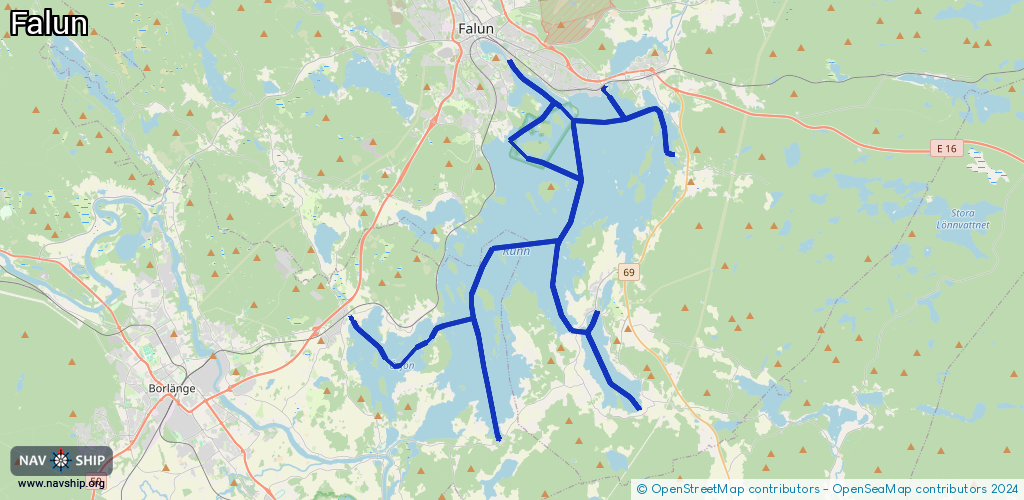
Route:
Please wait, loading route graphic...
Request waterway overview map with symbol legend here (Link).
Information about data associated with this body of water (16 available):
Data by OpenSeaMap (c) OSM contributors, www.openseamap.org
| # | Kind | Coordinates | Name | Information |
|---|---|---|---|---|
| 1 | Marina | 60.56419,15.76935 | 2021-10-19T14:03:50Z | Stabergs Båtklubb |
| 2 | Marina | 60.58877,15.67709 | 2020-11-29T10:10:16Z | Strandhamnens Marina |
| 3 | Marina | 60.58581,15.68357 | 2020-11-29T10:10:16Z | Runns SegelSällskap https://russ.se/ |
| 4 | Marina | 60.58686,15.68101 | 2020-11-29T10:10:16Z | Hälsinggårdens småbåtshamn |
| 5 | Marina | 60.59524,15.65473 | 2021-07-25T10:00:45Z | Falu Båtklubb |
| 6 | Marina | 60.51239,15.71591 | 2021-07-13T22:13:17Z | Vika Båtklubb |
| 7 | Marina | 60.57038,15.65193 | 2023-10-31T08:03:41Z | |
| 8 | Marina | 60.58748,15.71999 | 2021-05-21T22:39:24Z | |
| 9 | Marina | 60.5871,15.71997 | 2021-05-21T22:39:24Z | |
| 10 | Marina | 60.48436,15.74408 | 2024-01-06T23:24:29Z | |
| 11 | Marina | 60.50957,15.54673 | 2023-12-26T18:30:53Z | Kvarnhamnen Stora Ornäs |
| 12 | Marina | 60.50804,15.54552 | 2024-07-16T03:13:25Z | Ornäs Båtklubb https://ornasbatklubb.se/ |
| 13 | Slipway | 60.56475,15.76815 | small_craft_facility | 2018-06-27T17:11:16Z |
| 14 | Slipway | 60.59571,15.6552 | Unknown | 2024-03-15T07:53:47Z |
| 15 | Slipway | 60.5706,15.65145 | Unknown | 2010-12-11T23:15:14Z |
| 16 | Fuel station | 60.56466,15.76817 | 2018-06-27T17:11:17Z |