Waterway information

Kind:
Inland
Driving areas:
🇮🇹 Italy🌊 Sea Mediterranean
Length:
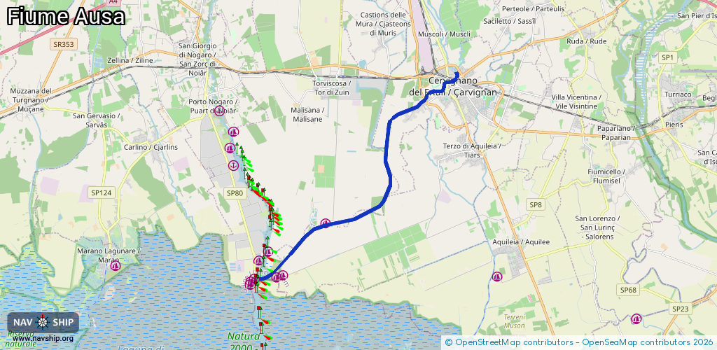
12.4 km¹
¹River kilometers or bank length recorded in NavShip, including river arms and harbor entrances.
Availability:
Completely recorded
Recent Update: 30.08.2021²
² This date indicates when an adjustment last took place in the course of the body of water
Recorded:
Locks: 0
Harbours / marinas: 3
Bridges: 0
Berths: 0
Slipways: 0
Fuelstations: 0
Route:
Please wait, loading route graphic...
Request waterway overview map with symbol legend here (Link).
Information about data associated with this body of water (3 available):
Data by OpenSeaMap (c) OSM contributors, www.openseamap.org
| # | Kind | Coordinates | Name | Information |
|---|---|---|---|---|
| 1 | Marina | 45.7758,13.27367 | 2024-10-23T11:00:11Z | Club Nautico Baiana Torviscosa https://cnbaiana.it/ |
| 2 | Marina | 45.75806,13.25286 | 2024-06-04T17:24:07Z | ASNAT |
| 3 | Marina | 45.75712,13.24966 | 2024-06-05T20:57:51Z | Marina di Salmastro |