Waterway information

Kind:
Inland
Driving areas:
🇮🇹 Italy🌊 Sea Mediterranean
Length:
6.7 km¹
¹River kilometers or bank length recorded in NavShip, including river arms and harbor entrances.
Availability:
Completely recorded
Recent Update: 04.03.2025²
² This date indicates when an adjustment last took place in the course of the body of water
Recorded:
Locks: 0
Harbours / marinas: 6
Bridges: 0
Berths: 0
Slipways: 0
Fuelstations: 0
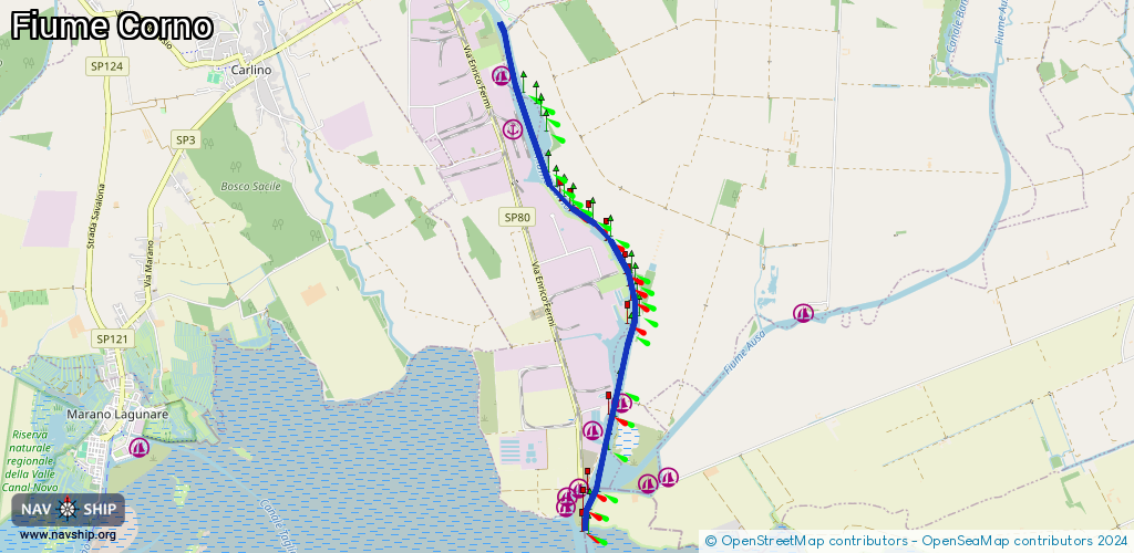
Route:
Please wait, loading route graphic...
Request waterway overview map with symbol legend here (Link).
Information about data associated with this body of water (6 available):
Data by OpenSeaMap (c) OSM contributors, www.openseamap.org
| # | Kind | Coordinates | Name | Information |
|---|---|---|---|---|
| 1 | Marina | 45.76334,13.24201 | 2024-06-05T20:57:51Z | Marina&Shipyard Sant'Andrea |
| 2 | Marina | 45.76627,13.24574 | 2024-06-05T20:57:51Z | Circolo nautico Airone 90 |
| 3 | Marina | 45.79579,13.22917 | 2022-01-12T15:23:28Z | Banchina Margreth Porto Nogaro |
| 4 | Marina | 45.80121,13.22739 | 2024-06-05T20:57:51Z | Marina San Giorgio di Nogaro |
| 5 | Marina | 45.80717,13.22875 | 2025-08-27T19:06:20Z | |
| 6 | Marina | 45.8141,13.22193 | 2023-05-12T20:16:44Z | Porto Vecchio Porto Nogaro |