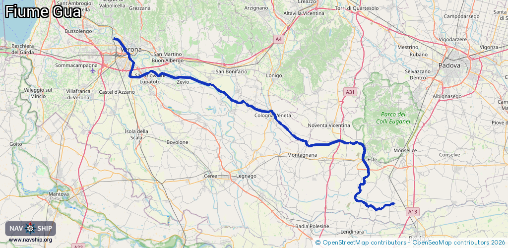
Waterway information

Kind:
Lower
Driving areas:
🇮🇹 Italy
Length:
94.7 km¹
¹River kilometers or bank length recorded in NavShip, including river arms and harbor entrances.
Availability:
Completely recorded
Recent Update: 09.04.2025²
² This date indicates when an adjustment last took place in the course of the body of water
Recorded:
Locks: 4
Harbours / marinas: 0
Bridges: 0
Berths: 0
Slipways: 0
Fuelstations: 0
Route:
Please wait, loading route graphic...
Request waterway overview map with symbol legend here (Link).
Information about data associated with this body of water (4 available):
Data by OpenSeaMap (c) OSM contributors, www.openseamap.org
| # | Kind | Coordinates | Name | Information |
|---|---|---|---|---|
| 1 | Lock | 45.32896,11.31797 | Unknown | |
| 2 | Lock | 45.36976,11.20631 | Unknown | |
| 3 | Lock | 45.38413,11.15273 | Unknown | |
| 4 | Lock | 45.3875,11.06536 | Unknown |