Waterway information

Kind:
Inland
Driving areas:
🇺🇸 United States of America
Length:
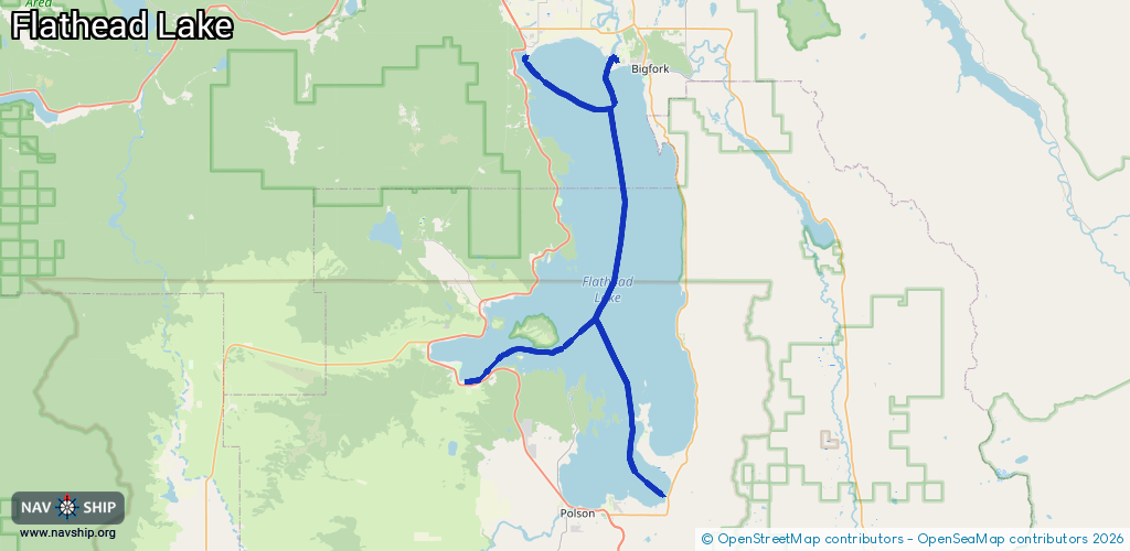
69.1 km¹
¹River kilometers or bank length recorded in NavShip, including river arms and harbor entrances.
Availability:
Completely recorded
Recent Update: 12.02.2025²
² This date indicates when an adjustment last took place in the course of the body of water
Recorded:
Locks: 0
Harbours / marinas: 3
Bridges: 0
Berths: 0
Slipways: 0
Fuelstations: 0
Route:
Please wait, loading route graphic...
Request waterway overview map with symbol legend here (Link).
Information about data associated with this body of water (3 available):
Data by OpenSeaMap (c) OSM contributors, www.openseamap.org
| # | Kind | Coordinates | Name | Information |
|---|---|---|---|---|
| 1 | Marina | 48.07447,-114.22738 | 2021-07-26T21:53:41Z | North Flathead Yacht Club |
| 2 | Marina | 48.06921,-114.1141 | 2024-12-19T21:18:17Z | Eagle Bend Yacht Harbour |
| 3 | Marina | 47.80377,-114.27816 | 2025-02-09T20:11:16Z | Flathead Lake Private Harbor +14068330940 https://www.flatheadlakeprivateharbor.com/ |