Waterway information

Kind:
Inland
Driving areas:
🇳🇱 Netherlands
Length:
10.8 km¹
¹River kilometers or bank length recorded in NavShip, including river arms and harbor entrances.
Availability:
Completely recorded
Recent Update: 28.09.2023²
² This date indicates when an adjustment last took place in the course of the body of water
Recorded:
Locks: 0
Harbours / marinas: 1
Bridges: 2
Berths: 1
Slipways: 0
Fuelstations: 0
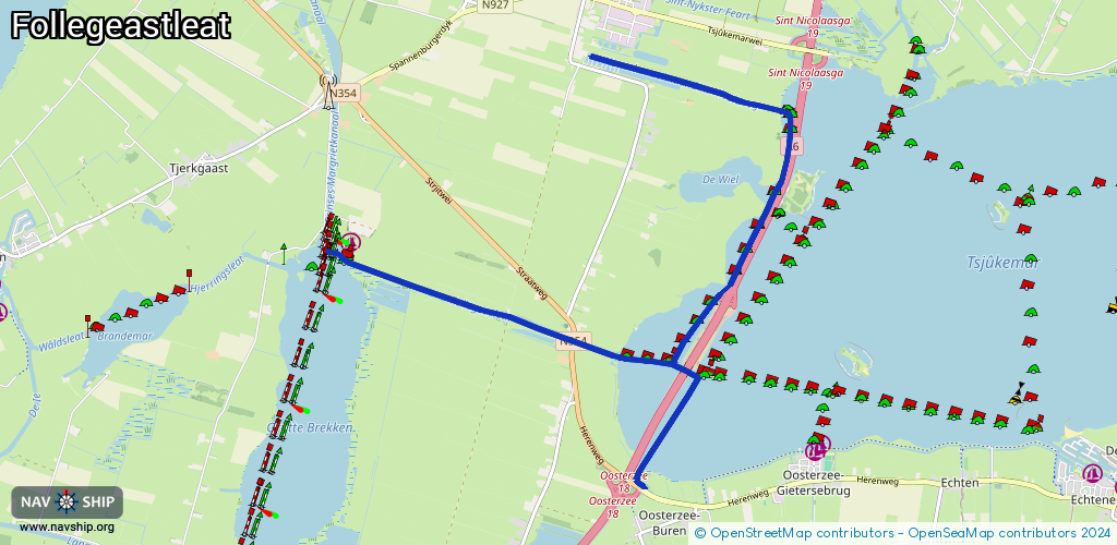
Route:
Please wait, loading route graphic...
Request waterway overview map with symbol legend here (Link).
Information about data associated with this body of water (4 available):
Data by OpenSeaMap (c) OSM contributors, www.openseamap.org
| # | Kind | Coordinates | Name | Information |
|---|---|---|---|---|
| 1 | Marina | 52.89631,5.70234 | 2022-06-06T06:42:35Z | Yachthaven De Lytse Brekken [email protected] +31 6 18908359 https://www.delytsebrekken.nl/ |
| 2 | Bridge | 52.88418,5.75523 | 45.69 | Clearance height: 2018-08-08T16:19:53Z m Maximum passage width: 12 m Movable bridge (e.g. lifting bridge or drawbridge) fixed |
| 3 | Bridge | 52.88699,5.73736 | 7.9 | Clearance height: 2025-09-04T13:09:28Z m Maximum passage width: 1.4 m Movable bridge (e.g. lifting bridge or drawbridge) bascule BB H12.5 W80 Follegasloot |
| 4 | Berth | 52.90251,5.77184 | 2023-11-21T00:33:16Z | TJ08C |