Waterway information

Kind:
Inland
Driving areas:
🌊 North Sea🇬🇧 United Kingdom
Length:
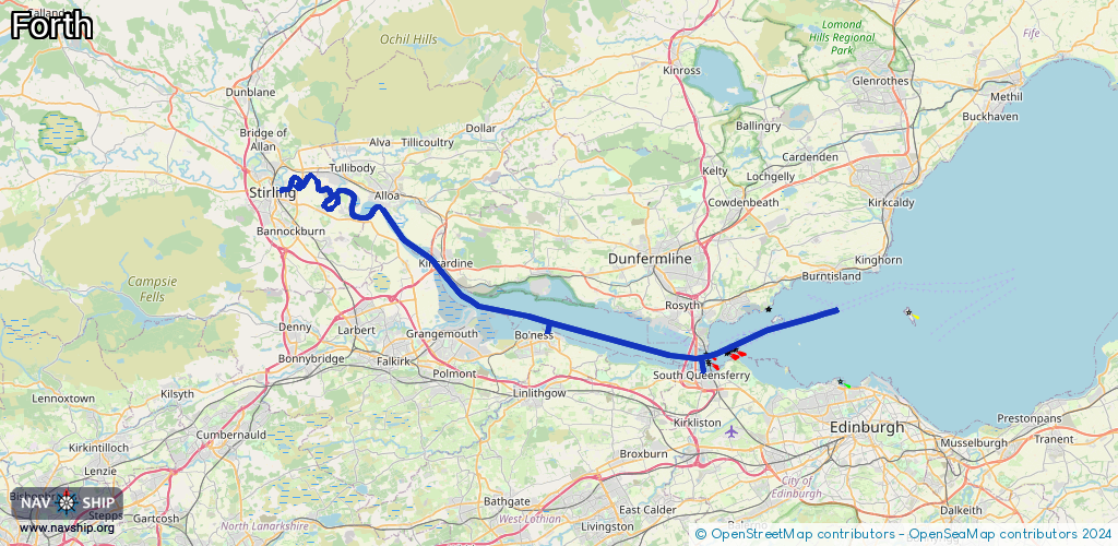
58.8 km¹
¹River kilometers or bank length recorded in NavShip, including river arms and harbor entrances.
Availability:
Completely recorded
Recent Update: 08.04.2025²
² This date indicates when an adjustment last took place in the course of the body of water
Recorded:
Locks: 0
Harbours / marinas: 3
Bridges: 0
Berths: 0
Slipways: 1
Fuelstations: 0
Route:
Please wait, loading route graphic...
Request waterway overview map with symbol legend here (Link).
Information about data associated with this body of water (4 available):
Data by OpenSeaMap (c) OSM contributors, www.openseamap.org
| # | Kind | Coordinates | Name | Information |
|---|---|---|---|---|
| 1 | Marina | 55.99158,-3.39636 | 2026-01-23T14:56:50Z | |
| 2 | Marina | 55.99352,-3.40948 | 2023-03-28T13:01:50Z | Port Edgar [email protected] +44 131 331 3330 https://www.portedgar.co.uk/ |
| 3 | Marina | 56.01838,-3.59201 | 2023-02-10T15:58:56Z | Upper Forth Boat Club |
| 4 | Slipway | 55.99424,-3.40912 | small_craft_facility | 2025-12-11T12:51:53Z |