Waterway information

Kind:
Inland
Driving areas:
🌊 Atlantic Ocean🇺🇸 United States of America
Length:
4.8 km¹
¹River kilometers or bank length recorded in NavShip, including river arms and harbor entrances.
Availability:
Completely recorded
Recent Update: 13.02.2024²
² This date indicates when an adjustment last took place in the course of the body of water
Recorded:
Locks: 0
Harbours / marinas: 7
Bridges: 0
Berths: 0
Slipways: 0
Fuelstations: 0
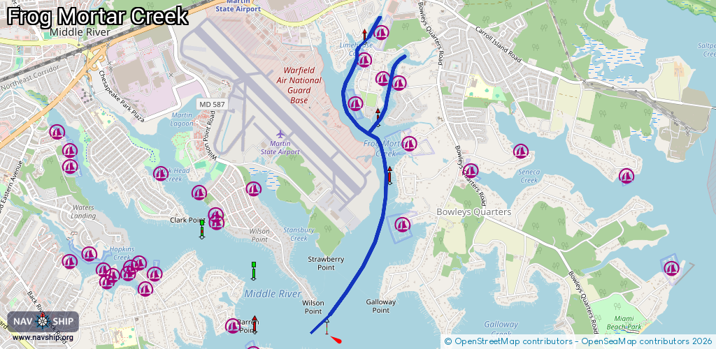
Route:
Please wait, loading route graphic...
Request waterway overview map with symbol legend here (Link).
Information about data associated with this body of water (7 available):
Data by OpenSeaMap (c) OSM contributors, www.openseamap.org
| # | Kind | Coordinates | Name | Information |
|---|---|---|---|---|
| 1 | Marina | 39.32929,-76.40024 | 2020-05-19T21:33:26Z | Brigadoon Marine Facility |
| 2 | Marina | 39.32984,-76.40226 | 2020-05-19T21:33:26Z | Tradewinds Marina +1 410 335 7000 |
| 3 | Marina | 39.3164,-76.39952 | 2020-05-19T21:33:26Z | Long Beach Marina +1 410 335 8602 |
| 4 | Marina | 39.32372,-76.39917 | 2020-05-19T21:33:26Z | Maryland Marina +1 410 335 8722 |
| 5 | Marina | 39.32749,-76.40545 | 2020-05-19T21:33:26Z | Parkside Marina +1 410 344 1187 |
| 6 | Marina | 39.33151,-76.40439 | 2020-05-19T21:33:26Z | Edwards Boat Yard +1 410 335 2311 |
| 7 | Marina | 39.33427,-76.40251 | 2020-05-19T21:33:26Z | Chesapeake Yachting Center +1 410 335 4900 |