Waterway information

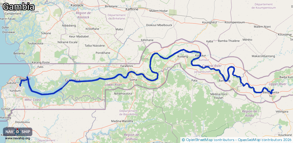
Kind:
Inland
Driving areas:
🌊 Atlantic Ocean🇬🇲 Gambia
Length:
416.8 km¹
¹River kilometers or bank length recorded in NavShip, including river arms and harbor entrances.
Availability:
Completely recorded
Recent Update: 04.04.2025²
² This date indicates when an adjustment last took place in the course of the body of water
Recorded:
Locks: 0
Harbours / marinas: 2
Bridges: 1
Berths: 1
Slipways: 0
Fuelstations: 0
Route:
Please wait, loading route graphic...
Request waterway overview map with symbol legend here (Link).
Information about data associated with this body of water (4 available):
Data by OpenSeaMap (c) OSM contributors, www.openseamap.org
| # | Kind | Coordinates | Name | Information |
|---|---|---|---|---|
| 1 | Marina | 13.69278,-15.32449 | 2023-11-25T17:49:02Z | |
| 2 | Marina | 13.44534,-16.57174 | 2023-06-25T12:08:42Z | Port of Banjul [email protected] +220 422 7266 http://www.gambiaports.com/ |
| 3 | Bridge | 13.51618,-15.57241 | 12 | Clearance height: 2024-09-23T19:38:45Z m Maximum passage width: 20 m Movable bridge (e.g. lifting bridge or drawbridge) fixed |
| 4 | Berth | 13.39353,-16.62333 | 2024-01-24T23:42:30Z | small_craft |