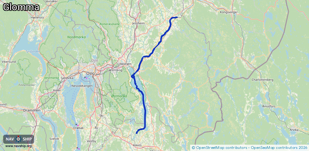
Waterway information

Kind:
Inland
Driving areas:
🇳🇴 Norway
Length:
78.3 km¹
¹River kilometers or bank length recorded in NavShip, including river arms and harbor entrances.
Availability:
Completely recorded
Recent Update: 24.01.2024²
² This date indicates when an adjustment last took place in the course of the body of water
Recorded:
Locks: 0
Harbours / marinas: 3
Bridges: 3
Berths: 0
Slipways: 0
Fuelstations: 0
Route:
Please wait, loading route graphic...
Request waterway overview map with symbol legend here (Link).
Information about data associated with this body of water (6 available):
Data by OpenSeaMap (c) OSM contributors, www.openseamap.org
| # | Kind | Coordinates | Name | Information |
|---|---|---|---|---|
| 1 | Marina | 59.89818,11.11229 | 2025-06-29T07:52:43Z | https://photos.app.goo.gl/NaM9fHZb1fVvzEQQ6 |
| 2 | Marina | 60.12441,11.463 | 2023-10-05T19:48:29Z | Årnes brygge https://www.arnesbatforening.com/ |
| 3 | Marina | 59.98877,11.23708 | 2021-07-30T17:31:55Z | Sørumsand Båthavn |
| 4 | Bridge | 60.12371,11.45869 | Unknown | Clearance height: 2022-10-31T02:18:02Z m Movable bridge (e.g. lifting bridge or drawbridge) fixed https://photos.app.goo.gl/ZascSocY4oVXk2836 |
| 5 | Bridge | 60.03436,11.33524 | Unknown | Clearance height: 2022-10-31T02:18:02Z m Movable bridge (e.g. lifting bridge or drawbridge) fixed https://photos.app.goo.gl/VuqV5qzuAgrQhc3b9 |
| 6 | Bridge | 60.03099,11.32831 | Unknown | Clearance height: 2024-12-31T12:40:17Z m Movable bridge (e.g. lifting bridge or drawbridge) fixed https://photos.app.goo.gl/DjZ2fC2mShY4wvpYA |