Waterway information

Kind:
Inland
Driving areas:
🇸🇪 Sweden
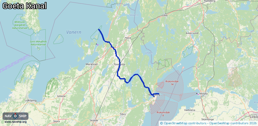
Length:
77.5 km¹
¹River kilometers or bank length recorded in NavShip, including river arms and harbor entrances.
Availability:
Completely recorded
Recent Update: 06.05.2025²
² This date indicates when an adjustment last took place in the course of the body of water
Recorded:
Locks: 8
Harbours / marinas: 1
Bridges: 0
Berths: 0
Slipways: 2
Fuelstations: 1
Route:
Please wait, loading route graphic...
Request waterway overview map with symbol legend here (Link).
Information about data associated with this body of water (12 available):
Data by OpenSeaMap (c) OSM contributors, www.openseamap.org
| # | Kind | Coordinates | Name | Information |
|---|---|---|---|---|
| 1 | Marina | 58.83798,13.97242 | 2017-09-11T09:00:32Z | Sjötorps båthamn http://sbk.sjotorp.nu/ |
| 2 | Slipway | 58.52549,14.50149 | small_craft_facility | 2021-12-22T01:55:31Z |
| 3 | Slipway | 58.52606,14.50179 | small_craft_facility | 2021-12-22T01:55:31Z |
| 4 | Fuel station | 58.54149,14.50525 | 2024-10-23T12:13:11Z | |
| 5 | Lock | 58.57548,14.43524 | Unknown | |
| 6 | Lock | 58.61,14.19176 | Unknown | |
| 7 | Lock | 58.74806,14.1076 | Unknown | |
| 8 | Lock | 58.75056,14.10443 | Unknown | |
| 9 | Lock | 58.75779,14.09055 | Unknown | |
| 10 | Lock | 58.8314,14.01555 | Unknown | |
| 11 | Lock | 58.83507,13.99053 | Unknown | |
| 12 | Lock | 58.83637,13.97943 | Unknown |