Waterway information

Kind:
Inland
Driving areas:
🇩🇪 Germany
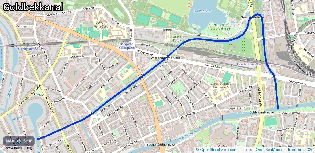
Length:
3.4 km¹
¹River kilometers or bank length recorded in NavShip, including river arms and harbor entrances.
Availability:
Completely recorded
Recent Update: 06.07.2025²
² This date indicates when an adjustment last took place in the course of the body of water
Recorded:
Locks: 0
Harbours / marinas: 0
Bridges: 13
Berths: 0
Slipways: 0
Fuelstations: 0
Route:
Please wait, loading route graphic...
Request waterway overview map with symbol legend here (Link).
Information about data associated with this body of water (13 available):
Data by OpenSeaMap (c) OSM contributors, www.openseamap.org
| # | Kind | Coordinates | Name | Information |
|---|---|---|---|---|
| 1 | Bridge | 53.58771,10.0354 | Unknown | Clearance height: 2019-10-03T19:38:23Z m |
| 2 | Bridge | 53.58887,10.03427 | Unknown | Clearance height: 2019-10-03T19:38:23Z m |
| 3 | Bridge | 53.59091,10.03401 | Unknown | Clearance height: 2019-10-03T19:38:23Z m |
| 4 | Bridge | 53.59277,10.03235 | Unknown | Clearance height: 2019-10-03T19:38:23Z m |
| 5 | Bridge | 53.5917,10.03151 | Unknown | Clearance height: 2019-10-03T19:38:23Z m |
| 6 | Bridge | 53.59112,10.02483 | Unknown | Clearance height: 2022-04-20T18:40:06Z m |
| 7 | Bridge | 53.59024,10.02201 | Unknown | Clearance height: 2019-10-03T19:38:23Z m |
| 8 | Bridge | 53.58932,10.02039 | Unknown | Clearance height: 2019-10-03T19:38:23Z m |
| 9 | Bridge | 53.58764,10.01682 | Unknown | Clearance height: 2019-10-03T19:38:23Z m |
| 10 | Bridge | 53.58464,10.00985 | Unknown | Clearance height: 2019-10-03T19:38:23Z m |
| 11 | Bridge | 53.58384,10.00743 | Unknown | Clearance height: 2019-10-03T19:38:23Z m |
| 12 | Bridge | 53.58335,10.00563 | Unknown | Clearance height: 2019-10-03T19:38:23Z m |
| 13 | Bridge | 53.58265,10.00279 | Unknown | Clearance height: 2019-10-03T19:38:23Z m |