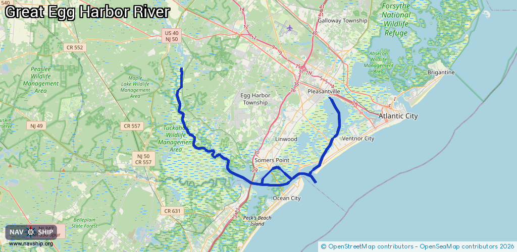
Waterway information

Kind:
Inland
Driving areas:
🌊 Atlantic Ocean🇺🇸 United States of America
Length:
44.3 km¹
¹River kilometers or bank length recorded in NavShip, including river arms and harbor entrances.
Availability:
Completely recorded
Recent Update: 13.12.2025²
² This date indicates when an adjustment last took place in the course of the body of water
Recorded:
Locks: 0
Harbours / marinas: 5
Bridges: 0
Berths: 0
Slipways: 1
Fuelstations: 1
Route:
Please wait, loading route graphic...
Request waterway overview map with symbol legend here (Link).
Information about data associated with this body of water (7 available):
Data by OpenSeaMap (c) OSM contributors, www.openseamap.org
| # | Kind | Coordinates | Name | Information |
|---|---|---|---|---|
| 1 | Marina | 39.30924,-74.5959 | 2025-11-30T19:51:47Z | Smith's Marina |
| 2 | Marina | 39.30988,-74.59512 | 2025-11-30T19:51:47Z | Somers Point Marina |
| 3 | Marina | 39.31365,-74.59056 | 2025-11-30T19:51:47Z | Harbour Cove Marina |
| 4 | Marina | 39.41456,-74.71688 | 2020-05-19T21:33:26Z | |
| 5 | Marina | 39.28745,-74.62949 | 2024-12-11T03:03:31Z | Beesley's Point Sea-Doo Inc. |
| 6 | Slipway | 39.41442,-74.71662 | Unknown | 2019-07-05T13:03:45Z |
| 7 | Fuel station | 39.31142,-74.53901 | 2025-11-30T19:51:47Z | Seaview Harbor boat fuel station |