Waterway information

Kind:
Inland
Driving areas:
🌊 Atlantic Ocean🇺🇸 United States of America
Length:
2.2 km¹
¹River kilometers or bank length recorded in NavShip, including river arms and harbor entrances.
Availability:
Completely recorded
Recent Update: 01.04.2025²
² This date indicates when an adjustment last took place in the course of the body of water
Recorded:
Locks: 0
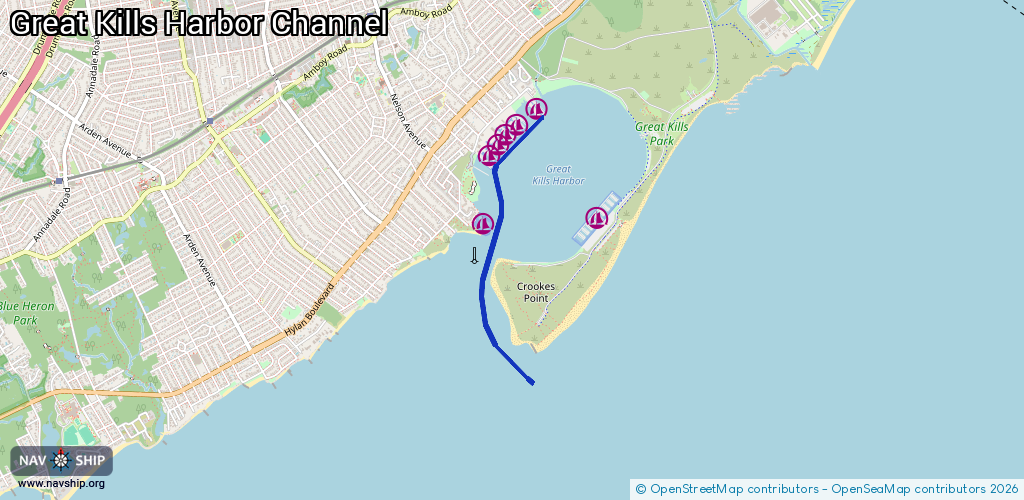
Harbours / marinas: 7
Bridges: 0
Berths: 0
Slipways: 0
Fuelstations: 0
Route:
Please wait, loading route graphic...
Request waterway overview map with symbol legend here (Link).
Information about data associated with this body of water (7 available):
Data by OpenSeaMap (c) OSM contributors, www.openseamap.org
| # | Kind | Coordinates | Name | Information |
|---|---|---|---|---|
| 1 | Marina | 40.53796,-74.13177 | 2022-01-02T07:31:46Z | Moonbeam Great Kills Marina |
| 2 | Marina | 40.53757,-74.14162 | 2022-06-10T18:46:41Z | |
| 3 | Marina | 40.54235,-74.14117 | 2024-09-25T20:47:20Z | Staten Island Marina |
| 4 | Marina | 40.54378,-74.13994 | 2022-01-01T09:09:44Z | Atlantis Marina |
| 5 | Marina | 40.543,-74.14034 | 2022-01-01T09:09:44Z | Captains Marina |
| 6 | Marina | 40.54536,-74.13717 | 2024-09-25T20:47:20Z | |
| 7 | Marina | 40.54452,-74.13881 | 2022-01-01T09:09:44Z | Mansion Marina |