Waterway information

Kind:
Inland
Driving areas:
🇺🇸 United States of America
Length:
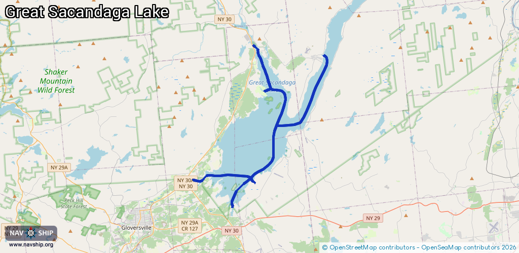
40.9 km¹
¹River kilometers or bank length recorded in NavShip, including river arms and harbor entrances.
Availability:
Completely recorded
Recent Update: 12.03.2025²
² This date indicates when an adjustment last took place in the course of the body of water
Recorded:
Locks: 0
Harbours / marinas: 6
Bridges: 0
Berths: 0
Slipways: 0
Fuelstations: 0
Route:
Please wait, loading route graphic...
Request waterway overview map with symbol legend here (Link).
Information about data associated with this body of water (6 available):
Data by OpenSeaMap (c) OSM contributors, www.openseamap.org
| # | Kind | Coordinates | Name | Information |
|---|---|---|---|---|
| 1 | Marina | 43.09688,-74.25605 | 2025-03-09T17:29:58Z | Doc's Marina |
| 2 | Marina | 43.07044,-74.21673 | 2021-03-18T15:50:05Z | |
| 3 | Marina | 43.10553,-74.17321 | 2025-01-19T22:29:05Z | Broadalbin Boat Launch https://www.dec.ny.gov/outdoor/23895.html |
| 4 | Marina | 43.2287,-74.18646 | 2025-02-02T19:18:13Z | Sacandaga River State Boat Launch https://www.dec.ny.gov/outdoor/23895.html |
| 5 | Marina | 43.1865,-74.17323 | 2021-02-27T04:11:04Z | Northampton Boatlaunch |
| 6 | Marina | 43.09522,-74.18624 | 2021-02-27T04:11:04Z | Marina |