Waterway information

Kind:
Inland
Driving areas:
🇳🇱 Netherlands🌊 North Sea
Length:
22.9 km¹
¹River kilometers or bank length recorded in NavShip, including river arms and harbor entrances.
Availability:
Completely recorded
Recent Update: 15.12.2021²
² This date indicates when an adjustment last took place in the course of the body of water
Recorded:
Locks: 2
Harbours / marinas: 2
Bridges: 5
Berths: 0
Slipways: 0
Fuelstations: 0
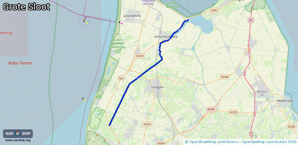
Route:
Please wait, loading route graphic...
Request waterway overview map with symbol legend here (Link).
Information about data associated with this body of water (9 available):
Data by OpenSeaMap (c) OSM contributors, www.openseamap.org
| # | Kind | Coordinates | Name | Information |
|---|---|---|---|---|
| 1 | Marina | 52.88226,4.87402 | 2023-05-31T16:45:07Z | Van Ewijcksluis +31 223 531 667 https://www.wvap.nl |
| 2 | Marina | 52.85783,4.83794 | 2024-12-28T09:58:10Z | Jachthaven Oude Veer |
| 3 | Bridge | 52.80488,4.76502 | Unknown | Clearance height: 2014-07-27T13:42:25Z m Maximum passage width: 2.38 m fixed |
| 4 | Bridge | 52.88338,4.87524 | 7.3 | Clearance height: 2022-06-06T07:48:37Z m Maximum passage width: 2 m Movable bridge (e.g. lifting bridge or drawbridge) opening |
| 5 | Bridge | 52.86044,4.83655 | 7.40 | Clearance height: 2022-06-06T07:48:36Z m Maximum passage width: 1.60 m Movable bridge (e.g. lifting bridge or drawbridge) opening |
| 6 | Bridge | 52.83495,4.81026 | 6.90 | Clearance height: 2020-07-06T11:45:09Z m Maximum passage width: 3.65 m Movable bridge (e.g. lifting bridge or drawbridge) fixed |
| 7 | Bridge | 52.80556,4.76652 | Unknown | Clearance height: 2020-07-06T11:45:09Z m Maximum passage width: 2.37 m fixed |
| 8 | Lock | 52.73315,4.69044 | Unknown | |
| 9 | Lock | 52.88347,4.87539 | Unknown |