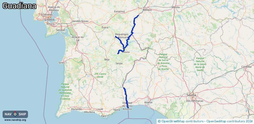
Waterway information

Kind:
Inland
Driving areas:
🌊 Atlantic Ocean🇵🇹 Portugal🇪🇸 Spain
Length:
189.8 km¹
¹River kilometers or bank length recorded in NavShip, including river arms and harbor entrances.
Availability:
Completely recorded
Recent Update: 04.01.2024²
² This date indicates when an adjustment last took place in the course of the body of water
Recorded:
Locks: 0
Harbours / marinas: 8
Bridges: 0
Berths: 0
Slipways: 0
Fuelstations: 0
Route:
Please wait, loading route graphic...
Request waterway overview map with symbol legend here (Link).
Information about data associated with this body of water (8 available):
Data by OpenSeaMap (c) OSM contributors, www.openseamap.org
| # | Kind | Coordinates | Name | Information |
|---|---|---|---|---|
| 1 | Marina | 38.73599,-7.22993 | 2021-08-03T09:38:09Z | |
| 2 | Marina | 38.73525,-7.22966 | 2021-08-03T09:38:09Z | Puerto Deportivo Villarreal |
| 3 | Marina | 38.73774,-7.23737 | 2024-10-01T12:29:33Z | Cais da Juromenha |
| 4 | Marina | 38.20206,-7.48862 | 2024-11-23T13:03:13Z | Cais Ancoradouro da Barragem de Alqueva |
| 5 | Marina | 37.21136,-7.40672 | 2021-10-06T09:51:17Z | Puerto Deportivo de Ayamonte |
| 6 | Marina | 37.202,-7.41467 | 2018-10-20T15:52:18Z | |
| 7 | Marina | 37.19179,-7.41361 | 2022-03-22T15:50:19Z | Capitania do Porto de Vila Real de Santo António http://autoridademaritima.marinha.pt/PT/Capitanias/departamentomaritimosul/vilareal/Pages/CapitaniadoPortodeVilaRealdeSantoAnt%C3%B3nio.aspx |
| 8 | Marina | 37.1947,-7.41362 | 2017-07-12T14:53:09Z | Porto de Recreio do Guadiana |