Waterway information

Kind:
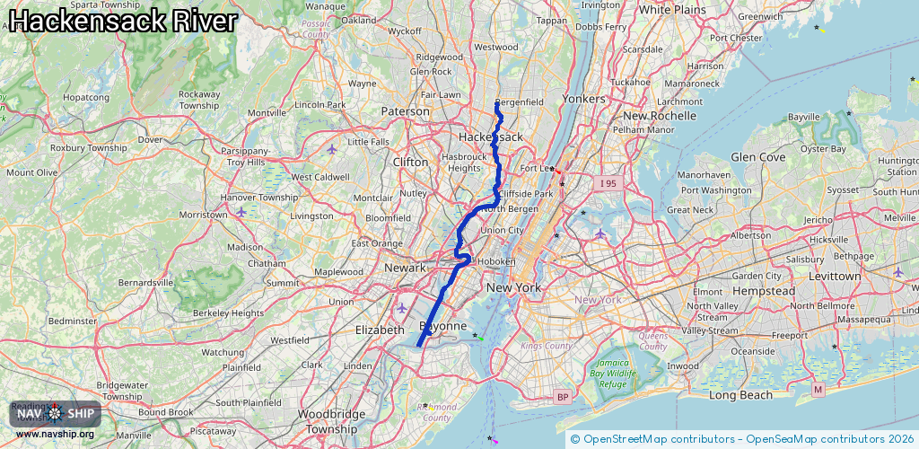
Inland
Driving areas:
🌊 Atlantic Ocean🇺🇸 United States of America
Length:
40.9 km¹
¹River kilometers or bank length recorded in NavShip, including river arms and harbor entrances.
Availability:
Completely recorded
Recent Update: 01.04.2025²
² This date indicates when an adjustment last took place in the course of the body of water
Recorded:
Locks: 0
Harbours / marinas: 7
Bridges: 0
Berths: 0
Slipways: 0
Fuelstations: 0
Route:
Please wait, loading route graphic...
Request waterway overview map with symbol legend here (Link).
Information about data associated with this body of water (7 available):
Data by OpenSeaMap (c) OSM contributors, www.openseamap.org
| # | Kind | Coordinates | Name | Information |
|---|---|---|---|---|
| 1 | Marina | 40.66039,-74.13346 | 2020-05-19T21:33:26Z | |
| 2 | Marina | 40.65692,-74.13784 | 2020-05-19T21:33:26Z | |
| 3 | Marina | 40.80703,-74.05765 | 2020-05-19T21:33:26Z | RIver Barge Marina |
| 4 | Marina | 40.80737,-74.05899 | 2022-05-18T21:24:44Z | Snipe Boat Club |
| 5 | Marina | 40.80001,-74.06572 | 2021-10-29T20:11:12Z | |
| 6 | Marina | 40.76392,-74.08661 | 2020-05-19T21:33:26Z | |
| 7 | Marina | 40.72968,-74.1007 | 2021-09-23T18:38:13Z | Passaic River Yacht Club http://www.passaicriverboatclub.inf o/PRBC/Joomla/ |