Waterway information

Kind:
Lower
Driving areas:
🌊 North Sea🇳🇴 Norway
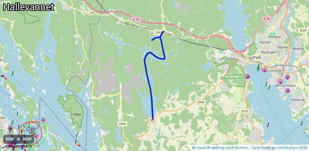
Length:
8.2 km¹
¹River kilometers or bank length recorded in NavShip, including river arms and harbor entrances.
Availability:
Completely recorded
Recent Update: 25.09.2023²
² This date indicates when an adjustment last took place in the course of the body of water
Recorded:
Locks: 0
Harbours / marinas: 0
Bridges: 0
Berths: 0
Slipways: 5
Fuelstations: 0
Route:
Please wait, loading route graphic...
Request waterway overview map with symbol legend here (Link).
Information about data associated with this body of water (5 available):
Data by OpenSeaMap (c) OSM contributors, www.openseamap.org
| # | Kind | Coordinates | Name | Information |
|---|---|---|---|---|
| 1 | Slipway | 59.06279,9.90935 | small_craft_facility | 2023-05-08T08:55:40Z Vassbotnfjorden |
| 2 | Slipway | 59.06806,9.92419 | small_craft_facility | 2023-05-08T08:55:40Z Vassbotn |
| 3 | Slipway | 59.05877,9.90766 | small_craft_facility | 2023-05-08T08:55:40Z Fagernes |
| 4 | Slipway | 59.01734,9.91116 | small_craft_facility | 2023-05-08T08:55:40Z Halle |
| 5 | Slipway | 59.01683,9.90991 | small_craft_facility | 2023-05-08T08:55:40Z Hallestranda |