Waterway information

Kind:
Lower
Driving areas:
🇩🇪 Germany
Length:
6 km¹
¹River kilometers or bank length recorded in NavShip, including river arms and harbor entrances.
Availability:
Completely recorded
Recent Update: 04.05.2023²
² This date indicates when an adjustment last took place in the course of the body of water
Recorded:
Locks: 0
Harbours / marinas: 2
Bridges: 0
Berths: 0
Slipways: 3
Fuelstations: 0
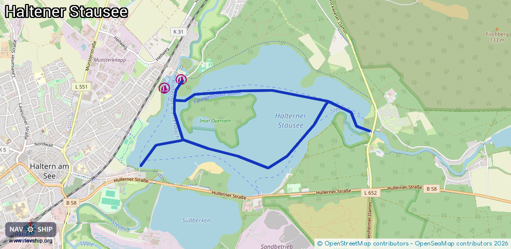
Route:
Please wait, loading route graphic...
Request waterway overview map with symbol legend here (Link).
Information about data associated with this body of water (5 available):
Data by OpenSeaMap (c) OSM contributors, www.openseamap.org
| # | Kind | Coordinates | Name | Information |
|---|---|---|---|---|
| 1 | Marina | 51.75188,7.20698 | 2019-03-11T06:54:27Z | Segelclub Mühlbachtal Haltern - SCMH [email protected] +49 1578 5247460 https://www.scmh.de/ |
| 2 | Marina | 51.75282,7.20988 | 2022-10-29T14:29:54Z | Segelclub Prinzensteg +49 2364 7158 https://www.segelclub-prinzensteg.de/ |
| 3 | Slipway | 51.74338,7.20267 | small_craft_facility | 2020-07-12T16:42:08Z Slipwagen auf Schienen mit Winde |
| 4 | Slipway | 51.753,7.207 | small_craft_facility | 2020-03-18T15:36:59Z |
| 5 | Slipway | 51.75299,7.20944 | small_craft_facility | 2020-03-18T15:36:59Z nur fuer Jollen auf Slipwagen geeignet |