Waterway information

Kind:
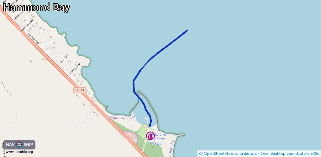
Inland
Driving areas:
🇺🇸 United States of America
Length:
1.3 km¹
¹River kilometers or bank length recorded in NavShip, including river arms and harbor entrances.
Availability:
Completely recorded
Recent Update: 04.03.2025²
² This date indicates when an adjustment last took place in the course of the body of water
Recorded:
Locks: 0
Harbours / marinas: 1
Bridges: 0
Berths: 0
Slipways: 0
Fuelstations: 0
Route:
Please wait, loading route graphic...
Request waterway overview map with symbol legend here (Link).
Information about data associated with this body of water (1 available):
Data by OpenSeaMap (c) OSM contributors, www.openseamap.org
| # | Kind | Coordinates | Name | Information |
|---|---|---|---|---|
| 1 | Marina | 45.59014,-84.16096 | 2025-10-09T17:17:54Z | Hammond Bay State Harbor Michigan Recreation Passport required for vehicle entry. Separate fee associated with marina usage by boat (see separate www.midnrreservations.com website for information). May-Sept +1-989-938-6291 https://www.michigandnr.com/publications/pdfs/harbor_guide/hammond_bay.htm |