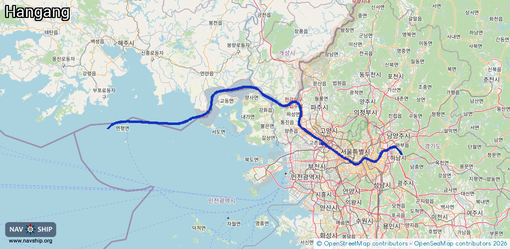
Waterway information

Kind:
Inland
Driving areas:
🇰🇵 Korea🇰🇷 Korea🌊 Pacific Ocean
Length:
180.6 km¹
¹River kilometers or bank length recorded in NavShip, including river arms and harbor entrances.
Availability:
Completely recorded
Recent Update: 23.07.2024²
² This date indicates when an adjustment last took place in the course of the body of water
Recorded:
Locks: 1
Harbours / marinas: 5
Bridges: 0
Berths: 0
Slipways: 0
Fuelstations: 0
Route:
Please wait, loading route graphic...
Request waterway overview map with symbol legend here (Link).
Information about data associated with this body of water (6 available):
Data by OpenSeaMap (c) OSM contributors, www.openseamap.org
| # | Kind | Coordinates | Name | Information |
|---|---|---|---|---|
| 1 | Marina | 37.60028,126.78949 | 2024-01-29T09:49:42Z | |
| 2 | Marina | 37.51877,127.08169 | 2025-10-13T01:13:46Z | 이랜드크루즈 잠실선착장 |
| 3 | Marina | 37.51312,126.99901 | 2021-03-30T08:40:37Z | |
| 4 | Marina | 37.50706,126.98446 | 2025-05-06T18:04:27Z | |
| 5 | Marina | 37.53498,126.91103 | 2022-12-11T11:50:33Z | 서울마리나 |
| 6 | Lock | 37.59933,126.79837 | Ara Han River Gabmun |