Waterway information

Kind:
Inland
Driving areas:
🇩🇪 Germany🌊 North Sea
Length:
2 km¹
¹River kilometers or bank length recorded in NavShip, including river arms and harbor entrances.
Availability:
Completely recorded
Recent Update: 03.09.2019²
² This date indicates when an adjustment last took place in the course of the body of water
Recorded:
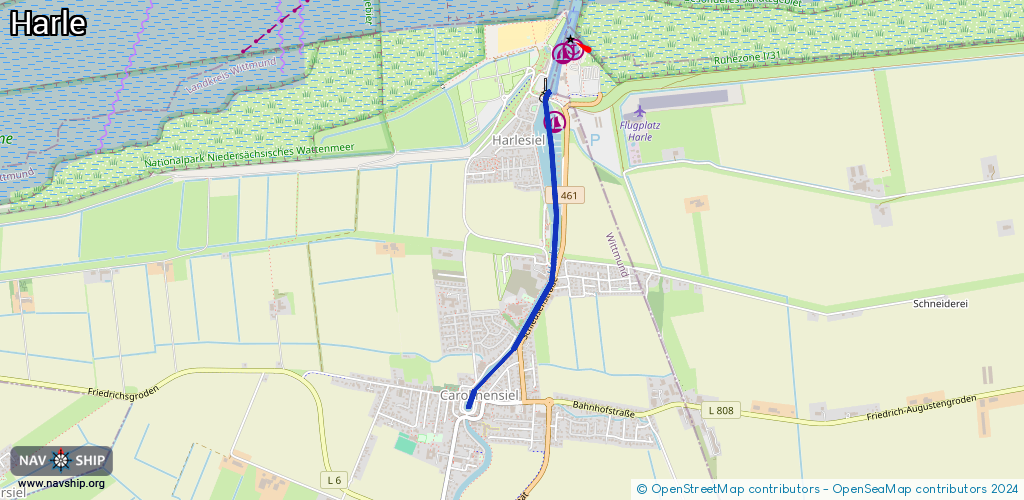
Locks: 1
Harbours / marinas: 1
Bridges: 1
Berths: 0
Slipways: 0
Fuelstations: 0
Route:
Please wait, loading route graphic...
Request waterway overview map with symbol legend here (Link).
Information about data associated with this body of water (3 available):
Data by OpenSeaMap (c) OSM contributors, www.openseamap.org
| # | Kind | Coordinates | Name | Information |
|---|---|---|---|---|
| 1 | Marina | 53.70547,7.80927 | 2019-03-27T19:32:53Z | YCH Yacht Club Harlesiel [email protected] +49 4464 472 https://www.yachtclub-harlesiel.de/ |
| 2 | Bridge | 53.69822,7.80908 | Unknown | Clearance height: 2013-01-10T13:59:44Z m fixed |
| 3 | Lock | 53.70672,7.80848 | Unknown |