Waterway information

Kind:
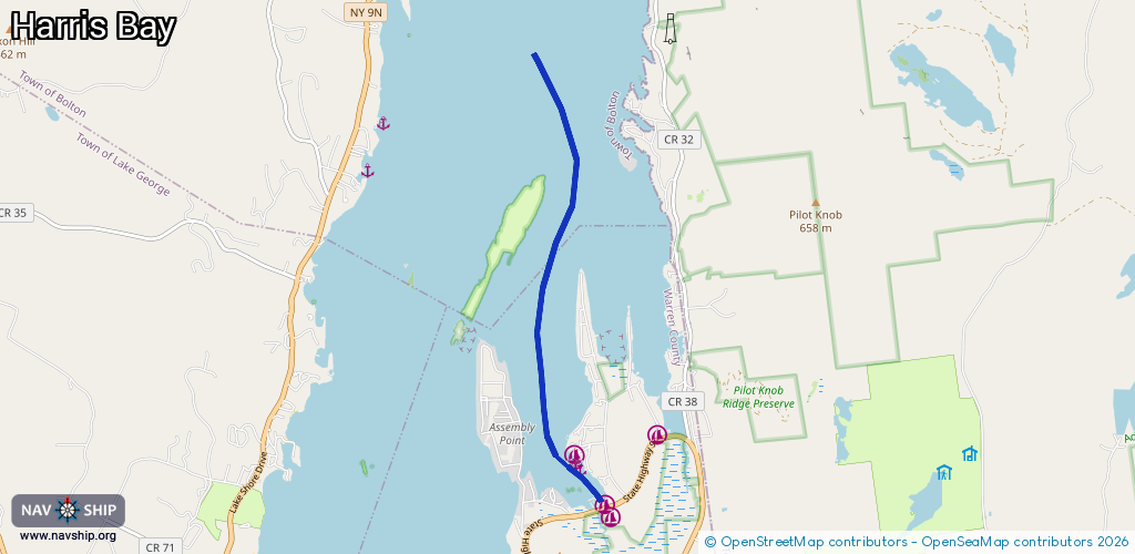
Inland
Driving areas:
🇺🇸 United States of America
Length:
6.1 km¹
¹River kilometers or bank length recorded in NavShip, including river arms and harbor entrances.
Availability:
Completely recorded
Recent Update: 01.02.2024²
² This date indicates when an adjustment last took place in the course of the body of water
Recorded:
Locks: 0
Harbours / marinas: 3
Bridges: 0
Berths: 3
Slipways: 0
Fuelstations: 0
Route:
Please wait, loading route graphic...
Request waterway overview map with symbol legend here (Link).
Information about data associated with this body of water (6 available):
Data by OpenSeaMap (c) OSM contributors, www.openseamap.org
| # | Kind | Coordinates | Name | Information |
|---|---|---|---|---|
| 1 | Marina | 43.46052,-73.64387 | 2021-11-15T17:56:49Z | Lake Geo. Boat Co. |
| 2 | Marina | 43.45494,-73.63938 | 2021-11-15T17:56:49Z | Harris Bay Yacht Club |
| 3 | Marina | 43.45331,-73.63889 | 2021-11-15T17:56:49Z | Harris Bay Yacht Club |
| 4 | Berth | 43.45954,-73.64365 | 2012-10-11T23:51:20Z | mooring area |
| 5 | Berth | 43.45959,-73.64343 | 2021-07-09T10:39:10Z | Mooring Area |
| 6 | Berth | 43.45886,-73.643 | 2021-07-09T10:39:10Z |