Waterway information

Kind:
Inland
Driving areas:
🇩🇪 Germany
Length:
18.6 km¹
¹River kilometers or bank length recorded in NavShip, including river arms and harbor entrances.
Availability:
Completely recorded
Recent Update: 10.01.2023²
² This date indicates when an adjustment last took place in the course of the body of water
Recorded:
Locks: 2
Harbours / marinas: 2
Bridges: 5
Berths: 0
Slipways: 0
Fuelstations: 0
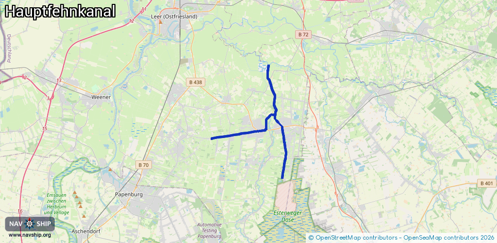
Route:
Please wait, loading route graphic...
Request waterway overview map with symbol legend here (Link).
Information about data associated with this body of water (7 available):
Data by OpenSeaMap (c) OSM contributors, www.openseamap.org
| # | Kind | Coordinates | Name | Information |
|---|---|---|---|---|
| 1 | Marina | 53.14501,7.60137 | 2023-05-11T09:33:57Z | WSV Ostrhauderfehn eV 1991 |
| 2 | Marina | 53.13699,7.5864 | 2025-11-17T09:43:40Z | Hafen Westrhauderfehn +49 4952 9032 |
| 3 | Bridge | 53.17897,7.59126 | Unknown | Clearance height: 2025-11-17T09:43:40Z m Movable bridge (e.g. lifting bridge or drawbridge) opening |
| 4 | Bridge | 53.16485,7.59882 | Unknown | Clearance height: 2025-11-17T09:43:40Z m Movable bridge (e.g. lifting bridge or drawbridge) opening |
| 5 | Bridge | 53.14236,7.60526 | Unknown | Clearance height: 2014-05-03T17:27:12Z m opening |
| 6 | Bridge | 53.14552,7.60045 | Unknown | Clearance height: 2014-04-30T10:42:59Z m opening |
| 7 | Bridge | 53.13723,7.58643 | Unknown | Clearance height: 2014-05-03T17:27:11Z m opening |
| 7 | Bridge | 53.13723,7.58643 | Unknown | Clearance height: 2014-05-03T17:27:11Z m opening |
| 7 | Bridge | 53.13723,7.58643 | Unknown | Clearance height: 2014-05-03T17:27:11Z m opening |