Waterway information

Kind:
Inland
Driving areas:
🇳🇱 Netherlands
Length:
7.4 km¹
¹River kilometers or bank length recorded in NavShip, including river arms and harbor entrances.
Availability:
Completely recorded
Recent Update: 05.12.2023²
² This date indicates when an adjustment last took place in the course of the body of water
Recorded:
Locks: 0
Harbours / marinas: 3
Bridges: 6
Berths: 0
Slipways: 0
Fuelstations: 0
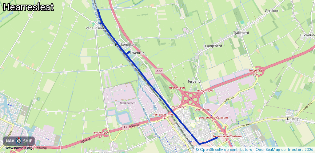
Route:
Please wait, loading route graphic...
Request waterway overview map with symbol legend here (Link).
Information about data associated with this body of water (9 available):
Data by OpenSeaMap (c) OSM contributors, www.openseamap.org
| # | Kind | Coordinates | Name | Information |
|---|---|---|---|---|
| 1 | Marina | 52.98968,5.88557 | 2021-01-05T09:27:15Z | De Lier |
| 2 | Marina | 52.98937,5.88441 | 2021-01-05T09:27:15Z | Kensoor |
| 3 | Marina | 52.99046,5.88191 | 2021-01-05T09:27:15Z | JW Haarsma |
| 4 | Bridge | 52.9614,5.91889 | 7 | Clearance height: 2018-07-29T17:05:18Z m Maximum passage width: 0.83 m Movable bridge (e.g. lifting bridge or drawbridge) opening |
| 5 | Bridge | 52.96252,5.91732 | 6.03 | Clearance height: 2013-04-03T08:48:48Z m Maximum passage width: 1.29 m Movable bridge (e.g. lifting bridge or drawbridge) opening |
| 6 | Bridge | 52.96706,5.91105 | 6.85 | Clearance height: 2018-07-29T17:05:18Z m Maximum passage width: 0.88 m Movable bridge (e.g. lifting bridge or drawbridge) opening |
| 7 | Bridge | 52.97055,5.90632 | 21 | Clearance height: 2018-07-29T17:05:18Z m Maximum passage width: 6.5 m Movable bridge (e.g. lifting bridge or drawbridge) fixed |
| 8 | Bridge | 52.97091,5.90584 | 19.6 | Clearance height: 2018-07-29T17:05:17Z m Maximum passage width: 7.5 m Movable bridge (e.g. lifting bridge or drawbridge) fixed |
| 9 | Bridge | 53.00071,5.8663 | 6 | Clearance height: 2018-07-29T17:05:13Z m Maximum passage width: 2.7 m fixed |