Waterway information

Kind:
Inland
Driving areas:
🇳🇱 Netherlands
Length:
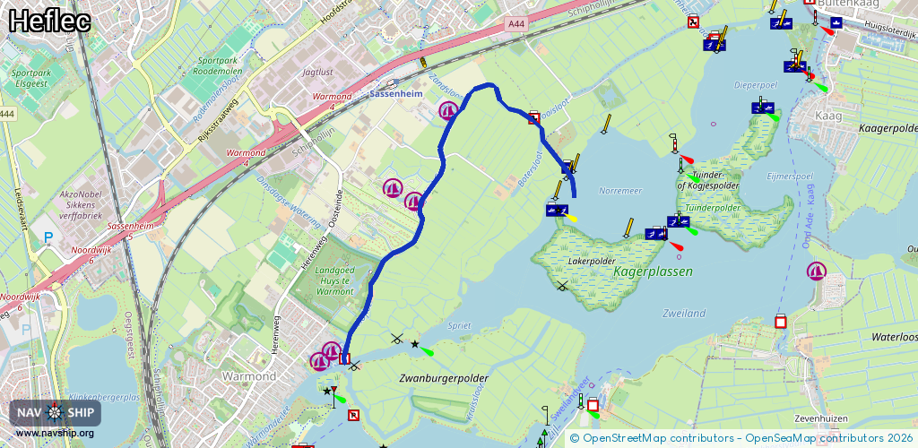
3.2 km¹
¹River kilometers or bank length recorded in NavShip, including river arms and harbor entrances.
Availability:
Completely recorded
Recent Update: 04.03.2025²
² This date indicates when an adjustment last took place in the course of the body of water
Recorded:
Locks: 0
Harbours / marinas: 4
Bridges: 2
Berths: 0
Slipways: 1
Fuelstations: 0
Route:
Please wait, loading route graphic...
Request waterway overview map with symbol legend here (Link).
Information about data associated with this body of water (7 available):
Data by OpenSeaMap (c) OSM contributors, www.openseamap.org
| # | Kind | Coordinates | Name | Information |
|---|---|---|---|---|
| 1 | Marina | 52.19949,4.51076 | 2022-06-02T22:37:53Z | Fort Marina https://www.fortmarina.nl/ |
| 2 | Marina | 52.20815,4.51879 | 2022-06-02T19:59:37Z | De Wasbeek |
| 3 | Marina | 52.209,4.51643 | 2022-05-30T10:46:12Z | Hoflee |
| 4 | Marina | 52.21342,4.52161 | 2022-05-30T10:14:27Z | Boerenjachthaven Van der Geest |
| 5 | Bridge | 52.20526,4.51691 | 3.5 | Clearance height: 2017-09-22T12:50:56Z m Maximum passage width: 0.6 m swing |
| 6 | Bridge | 52.21065,4.52137 | 3.5 | Clearance height: 2019-07-08T11:47:20Z m Maximum passage width: 0.7 m fixed |
| 7 | Slipway | 52.21337,4.5208 | Unknown | 2022-05-30T10:14:27Z |