Waterway information

Kind:
Inland
Driving areas:
🇺🇸 United States of America
Length:
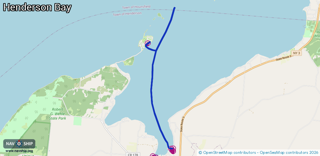
7.5 km¹
¹River kilometers or bank length recorded in NavShip, including river arms and harbor entrances.
Availability:
Completely recorded
Recent Update: 27.02.2024²
² This date indicates when an adjustment last took place in the course of the body of water
Recorded:
Locks: 0
Harbours / marinas: 13
Bridges: 0
Berths: 0
Slipways: 1
Fuelstations: 0
Route:
Please wait, loading route graphic...
Request waterway overview map with symbol legend here (Link).
Information about data associated with this body of water (14 available):
Data by OpenSeaMap (c) OSM contributors, www.openseamap.org
| # | Kind | Coordinates | Name | Information |
|---|---|---|---|---|
| 1 | Marina | 43.84936,-76.20906 | 2024-09-16T02:02:16Z | |
| 2 | Marina | 43.84855,-76.20857 | 2024-09-16T02:02:16Z | |
| 3 | Marina | 43.84863,-76.21051 | 2024-09-16T02:02:16Z | |
| 4 | Marina | 43.84873,-76.2108 | 2024-09-16T02:02:16Z | |
| 5 | Marina | 43.84976,-76.21085 | 2024-09-16T02:02:16Z | |
| 6 | Marina | 43.84888,-76.21179 | 2024-09-16T02:02:16Z | |
| 7 | Marina | 43.84855,-76.20922 | 2024-09-16T02:02:16Z | |
| 8 | Marina | 43.84913,-76.2101 | 2024-09-16T02:02:16Z | Henderson Harbor Marina |
| 9 | Marina | 43.85279,-76.20126 | 2024-02-25T01:33:47Z | |
| 10 | Marina | 43.85186,-76.20002 | 2024-09-16T02:02:16Z | |
| 11 | Marina | 43.85164,-76.19965 | 2024-09-16T02:02:16Z | |
| 12 | Marina | 43.8528,-76.19968 | 2024-09-16T02:02:16Z | |
| 13 | Marina | 43.89436,-76.21394 | 2024-02-08T21:04:46Z | |
| 14 | Slipway | 43.89389,-76.21525 | Unknown | 2016-04-26T12:03:03Z |