Waterway information

Kind:
Sea
Driving areas:
🇩🇰 Denmark
Length:
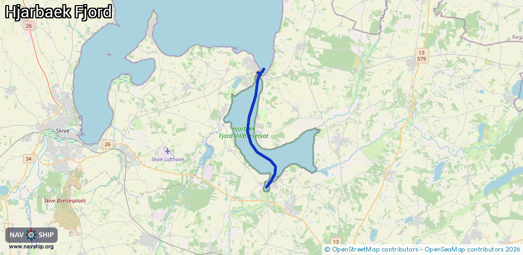
11.6 km¹
¹River kilometers or bank length recorded in NavShip, including river arms and harbor entrances.
Availability:
Completely recorded
Recent Update: 15.08.2023²
² This date indicates when an adjustment last took place in the course of the body of water
Recorded:
Locks: 1
Harbours / marinas: 3
Bridges: 0
Berths: 0
Slipways: 2
Fuelstations: 1
Route:
Please wait, loading route graphic...
Request waterway overview map with symbol legend here (Link).
Information about data associated with this body of water (7 available):
Data by OpenSeaMap (c) OSM contributors, www.openseamap.org
| # | Kind | Coordinates | Name | Information |
|---|---|---|---|---|
| 1 | Marina | 56.53121,9.31862 | 2013-04-03T10:49:55Z | Hjarbæk Havn |
| 2 | Marina | 56.52635,9.30024 | 2023-03-30T07:05:47Z | Kvols Havn |
| 3 | Marina | 56.60913,9.29138 | 2022-05-19T01:45:45Z | Virksund Lystbådehavn +45 97 539444 https://www.virksundlyst.dk/ |
| 4 | Slipway | 56.60624,9.29345 | small_craft_facility | 2024-10-22T10:35:02Z |
| 5 | Slipway | 56.53125,9.31959 | small_craft_facility | 2013-04-03T10:49:55Z |
| 6 | Fuel station | 56.60882,9.29087 | 2013-04-03T10:49:55Z | Diesel |
| 7 | Lock | 56.60564,9.29244 | Unknown |