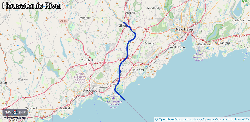
Waterway information

Kind:
Inland
Driving areas:
🌊 Atlantic Ocean🇺🇸 United States of America
Length:
22.7 km¹
¹River kilometers or bank length recorded in NavShip, including river arms and harbor entrances.
Availability:
Completely recorded
Recent Update: 08.04.2025²
² This date indicates when an adjustment last took place in the course of the body of water
Recorded:
Locks: 0
Harbours / marinas: 3
Bridges: 0
Berths: 0
Slipways: 1
Fuelstations: 0
Route:
Please wait, loading route graphic...
Request waterway overview map with symbol legend here (Link).
Information about data associated with this body of water (4 available):
Data by OpenSeaMap (c) OSM contributors, www.openseamap.org
| # | Kind | Coordinates | Name | Information |
|---|---|---|---|---|
| 1 | Marina | 41.22133,-73.10575 | 2021-04-17T11:37:15Z | Caswell Cove Marina |
| 2 | Marina | 41.2025,-73.11118 | 2022-01-25T21:02:14Z | Boardwalk Marina |
| 3 | Marina | 41.20053,-73.10718 | 2025-04-03T02:34:57Z | Village Marina |
| 4 | Slipway | 41.17925,-73.12446 | small_craft_facility | 2023-09-27T11:52:25Z |