Waterway information

Kind:
Sea
Driving areas:
🇳🇱 Netherlands
Length:
6.9 km¹
¹River kilometers or bank length recorded in NavShip, including river arms and harbor entrances.
Availability:
Completely recorded
Recent Update: 14.02.2025²
² This date indicates when an adjustment last took place in the course of the body of water
Recorded:
Locks: 0
Harbours / marinas: 1
Bridges: 4
Berths: 0
Slipways: 0
Fuelstations: 0
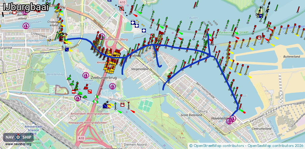
Route:
Please wait, loading route graphic...
Request waterway overview map with symbol legend here (Link).
Information about data associated with this body of water (5 available):
Data by OpenSeaMap (c) OSM contributors, www.openseamap.org
| # | Kind | Coordinates | Name | Information |
|---|---|---|---|---|
| 1 | Marina | 52.36834,4.9679 | 2025-09-09T14:47:43Z | Holland Sport Boat Centre [email protected] +31 20 694 7527 https://www.hollandsport.nl/ |
| 2 | Bridge | 52.35444,5.0059 | Unknown | Clearance height: 2023-08-08T14:59:47Z m Maximum passage width: 2.5 m Movable bridge (e.g. lifting bridge or drawbridge) bascule |
| 3 | Bridge | 52.36431,4.98383 | Unknown | Clearance height: 2020-10-15T14:24:48Z m Movable bridge (e.g. lifting bridge or drawbridge) opening |
| 4 | Bridge | 52.36492,4.97699 | Unknown | Clearance height: 2020-10-14T17:48:44Z m Movable bridge (e.g. lifting bridge or drawbridge) fixed |
| 5 | Bridge | 52.36521,4.97646 | Unknown | Clearance height: 2020-10-14T17:48:44Z m Movable bridge (e.g. lifting bridge or drawbridge) fixed |