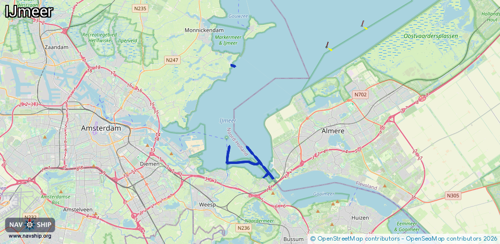
Waterway information

Kind:
Sea
Driving areas:
🇳🇱 Netherlands
Length:
10.2 km¹
¹River kilometers or bank length recorded in NavShip, including river arms and harbor entrances.
Availability:
Completely recorded
Recent Update: 19.09.2025²
² This date indicates when an adjustment last took place in the course of the body of water
Recorded:
Locks: 0
Harbours / marinas: 2
Bridges: 0
Berths: 0
Slipways: 3
Fuelstations: 0
Route:
Please wait, loading route graphic...
Request waterway overview map with symbol legend here (Link).
Information about data associated with this body of water (5 available):
Data by OpenSeaMap (c) OSM contributors, www.openseamap.org
| # | Kind | Coordinates | Name | Information |
|---|---|---|---|---|
| 1 | Marina | 52.42764,5.07538 | 2024-08-31T06:09:51Z | Marina Resort Uitdam +31 20 403 1433 https://www.campinguitdam.nl |
| 2 | Marina | 52.32999,5.11993 | 2022-06-06T07:46:27Z | Watersportcentrum Muiderberg [email protected] +31 6 51074236 https://www.wscmuiderberg.nl/ |
| 3 | Slipway | 52.42863,5.07514 | small_craft_facility | 2018-08-16T10:15:37Z |
| 4 | Slipway | 52.42864,5.07521 | small_craft_facility | 2017-04-02T10:59:47Z |
| 5 | Slipway | 52.42711,5.0742 | Unknown | 2024-08-31T06:09:51Z |