Waterway information

Kind:
Inland
Driving areas:
🇩🇪 Germany
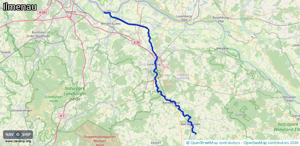
Length:
67.7 km¹
¹River kilometers or bank length recorded in NavShip, including river arms and harbor entrances.
Availability:
Completely recorded
Recent Update: 15.09.2025²
² This date indicates when an adjustment last took place in the course of the body of water
Recorded:
Locks: 3
Harbours / marinas: 2
Bridges: 0
Berths: 0
Slipways: 1
Fuelstations: 0
Route:
Please wait, loading route graphic...
Request waterway overview map with symbol legend here (Link).
Information about data associated with this body of water (6 available):
Data by OpenSeaMap (c) OSM contributors, www.openseamap.org
| # | Kind | Coordinates | Name | Information |
|---|---|---|---|---|
| 1 | Marina | 53.39256,10.18147 | 2025-12-08T23:18:35Z | Stöckter Hafen [email protected] +49 4171 3534 http://www.stoeckter-hafen-ev.de |
| 2 | Marina | 53.3926,10.19038 | 2023-11-06T20:46:37Z | Boots-Club Oberelbe [email protected] +49 4171 62222 https://www.bootsclub-oberelbe.de/h%C3%A4fen/hafen-st%C3%B6ckte/ |
| 3 | Slipway | 53.39222,10.18964 | small_craft_facility | 2022-08-04T13:07:08Z |
| 4 | Lock | 53.36034,10.31593 | Schleuse Fahrenholz | |
| 5 | Lock | 53.34186,10.38366 | Wittorf | |
| 6 | Lock | 53.29141,10.40102 | Bardowick |