Waterway information

Kind:
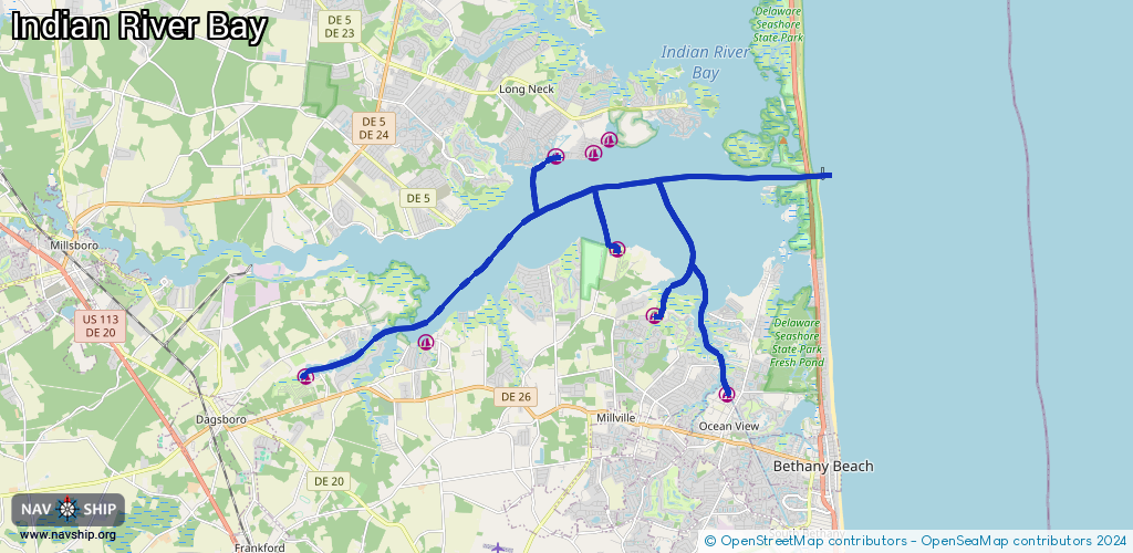
Inland
Driving areas:
🌊 Atlantic Ocean🇺🇸 United States of America
Length:
28.5 km¹
¹River kilometers or bank length recorded in NavShip, including river arms and harbor entrances.
Availability:
Completely recorded
Recent Update: 20.05.2025²
² This date indicates when an adjustment last took place in the course of the body of water
Recorded:
Locks: 0
Harbours / marinas: 7
Bridges: 0
Berths: 0
Slipways: 0
Fuelstations: 0
Route:
Please wait, loading route graphic...
Request waterway overview map with symbol legend here (Link).
Information about data associated with this body of water (7 available):
Data by OpenSeaMap (c) OSM contributors, www.openseamap.org
| # | Kind | Coordinates | Name | Information |
|---|---|---|---|---|
| 1 | Marina | 38.61296,-75.14175 | 2020-05-19T21:33:26Z | |
| 2 | Marina | 38.59049,-75.12279 | 2022-09-03T06:11:12Z | |
| 3 | Marina | 38.5596,-75.21939 | 2023-08-26T03:34:15Z | Gull's Way Marina |
| 4 | Marina | 38.5677,-75.18226 | 2024-02-15T10:48:57Z | |
| 5 | Marina | 38.60959,-75.06788 | 2022-12-23T20:02:44Z | Coast Guard Basin https://www.facebook.com/USCoastGuardStationIndianRiver/photos/a.382244238541204/440983722667255/?type=3&theater |
| 6 | Marina | 38.55522,-75.08867 | 2020-05-25T01:39:57Z | Harbor View Marina |
| 7 | Marina | 38.57424,-75.11091 | 2020-05-19T21:33:26Z | Bay Forest Marina |