Waterway information

Kind:
Lower
Driving areas:
🇦🇹 Austria🇩🇪 Germany
Length:
125.8 km¹
¹River kilometers or bank length recorded in NavShip, including river arms and harbor entrances.
Availability:
Completely recorded
Recent Update: 29.07.2024²
² This date indicates when an adjustment last took place in the course of the body of water
Recorded:
Locks: 0
Harbours / marinas: 0
Bridges: 0
Berths: 0
Slipways: 6
Fuelstations: 0
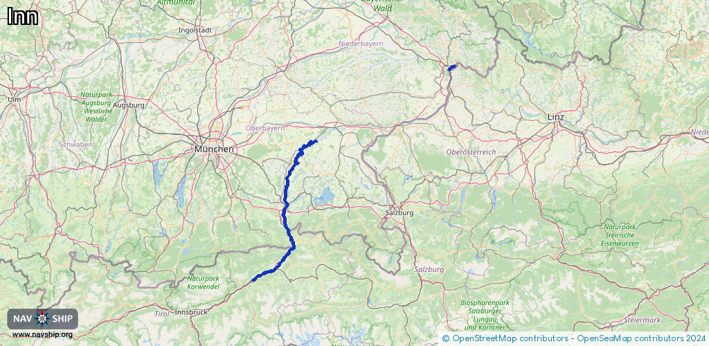
Route:
Please wait, loading route graphic...
Request waterway overview map with symbol legend here (Link).
Information about data associated with this body of water (6 available):
Data by OpenSeaMap (c) OSM contributors, www.openseamap.org
| # | Kind | Coordinates | Name | Information |
|---|---|---|---|---|
| 1 | Slipway | 48.17378,12.38299 | small_craft_facility | 2019-11-25T17:32:31Z |
| 2 | Slipway | 48.05552,12.21657 | small_craft_facility | 2019-11-25T16:50:53Z |
| 3 | Slipway | 47.84023,12.15472 | small_craft_facility | 2022-08-14T21:28:10Z |
| 4 | Slipway | 47.83553,12.15344 | small_craft_facility | 2019-11-25T16:50:53Z |
| 5 | Slipway | 47.74166,12.13453 | small_craft_facility | 2019-11-25T16:50:53Z |
| 6 | Slipway | 47.64495,12.19731 | small_craft_facility | 2022-08-14T21:28:10Z |