Waterway information

Kind:
Inland
Driving areas:
🇩🇪 Germany
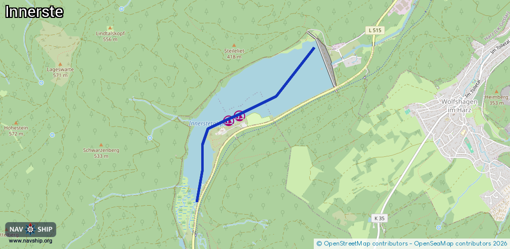
Length:
2.5 km¹
¹River kilometers or bank length recorded in NavShip, including river arms and harbor entrances.
Availability:
Completely recorded
Recent Update: 09.01.2023²
² This date indicates when an adjustment last took place in the course of the body of water
Recorded:
Locks: 0
Harbours / marinas: 2
Bridges: 0
Berths: 0
Slipways: 1
Fuelstations: 0
Route:
Please wait, loading route graphic...
Request waterway overview map with symbol legend here (Link).
Information about data associated with this body of water (3 available):
Data by OpenSeaMap (c) OSM contributors, www.openseamap.org
| # | Kind | Coordinates | Name | Information |
|---|---|---|---|---|
| 1 | Marina | 51.90928,10.28223 | 2013-01-16T16:51:21Z | Göttinger Segelclub [email protected] +49 5325 4420 http://segeln-in-goettingen.de |
| 2 | Marina | 51.90876,10.28037 | 2013-01-16T16:51:23Z | Seglervereinigung Innerste Delligsen [email protected] +49 5187 3766 http://www.svid.de |
| 3 | Slipway | 51.90926,10.28343 | small_craft_facility | 2018-08-01T11:55:02Z |