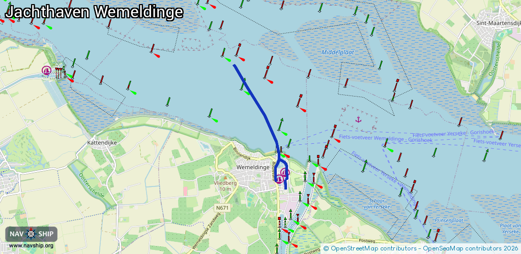
Waterway information

Kind:
Sea
Driving areas:
🇳🇱 Netherlands🌊 North Sea
Length:
3.8 km¹
¹River kilometers or bank length recorded in NavShip, including river arms and harbor entrances.
Availability:
Completely recorded
Recent Update: 31.10.2022²
² This date indicates when an adjustment last took place in the course of the body of water
Recorded:
Locks: 0
Harbours / marinas: 2
Bridges: 2
Berths: 0
Slipways: 1
Fuelstations: 0
Route:
Please wait, loading route graphic...
Request waterway overview map with symbol legend here (Link).
Information about data associated with this body of water (5 available):
Data by OpenSeaMap (c) OSM contributors, www.openseamap.org
| # | Kind | Coordinates | Name | Information |
|---|---|---|---|---|
| 1 | Marina | 51.51577,4.00391 | 2016-07-12T21:18:27Z | |
| 2 | Marina | 51.51723,4.00592 | 2016-07-12T21:18:27Z | |
| 3 | Bridge | 51.51679,4.00266 | 9 | Clearance height: 2016-07-23T11:38:55Z m Maximum passage width: 2 m opening |
| 4 | Bridge | 51.51553,4.00597 | 15 | Clearance height: 2016-07-12T21:18:27Z m Maximum passage width: 0.1 m opening |
| 5 | Slipway | 51.5152,4.00459 | small_craft_facility | 2023-07-21T08:42:43Z |