Waterway information

Kind:
Inland
Driving areas:
🌊 Atlantic Ocean🇺🇸 United States of America
Length:
28.2 km¹
¹River kilometers or bank length recorded in NavShip, including river arms and harbor entrances.
Availability:
Completely recorded
Recent Update: 01.04.2025²
² This date indicates when an adjustment last took place in the course of the body of water
Recorded:
Locks: 0
Harbours / marinas: 6
Bridges: 1
Berths: 0
Slipways: 2
Fuelstations: 1
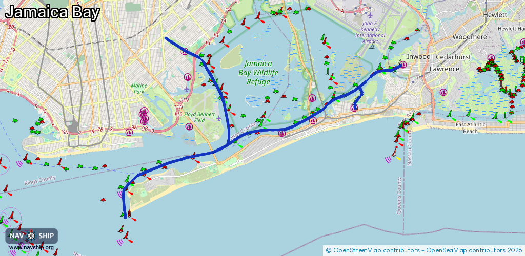
Route:
Please wait, loading route graphic...
Request waterway overview map with symbol legend here (Link).
Information about data associated with this body of water (10 available):
Data by OpenSeaMap (c) OSM contributors, www.openseamap.org
| # | Kind | Coordinates | Name | Information |
|---|---|---|---|---|
| 1 | Marina | 40.61761,-73.75733 | 2022-04-18T00:43:29Z | Inwood Marina |
| 2 | Marina | 40.60067,-73.81818 | 2020-09-18T19:12:13Z | |
| 3 | Marina | 40.58924,-73.81765 | 2021-12-23T19:39:29Z | |
| 4 | Marina | 40.58288,-73.83853 | 2022-03-24T16:50:52Z | |
| 5 | Marina | 40.59532,-73.79016 | 2020-05-19T21:33:26Z | 59th Street Marina |
| 6 | Marina | 40.62436,-73.90354 | 2022-01-28T13:49:31Z | |
| 7 | Bridge | 40.5959,-73.81063 | 30.7 | Clearance height: 2026-01-14T01:43:07Z m Maximum passage width: 7.9 m swing |
| 8 | Slipway | 40.61753,-73.75789 | Unknown | 2016-09-12T22:50:58Z |
| 9 | Slipway | 40.59494,-73.78937 | Unknown | 2018-11-01T16:41:35Z |
| 10 | Fuel station | 40.58314,-73.83515 | 2023-08-01T23:53:12Z | Gas Dock (Sunoco) |