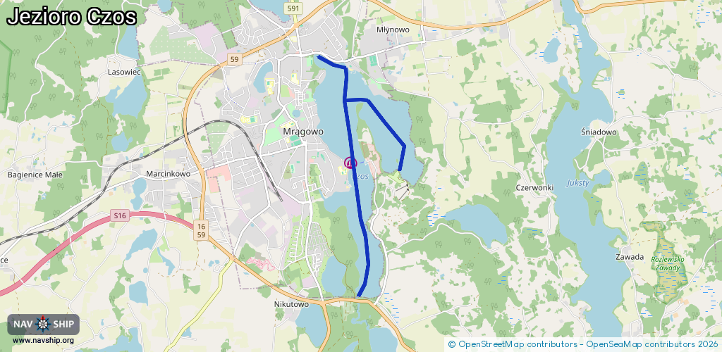
Waterway information

Kind:
Inland
Driving areas:
🇵🇱 Poland
Length:
5.9 km¹
¹River kilometers or bank length recorded in NavShip, including river arms and harbor entrances.
Availability:
Completely recorded
Recent Update: 10.10.2023²
² This date indicates when an adjustment last took place in the course of the body of water
Recorded:
Locks: 0
Harbours / marinas: 1
Bridges: 0
Berths: 0
Slipways: 2
Fuelstations: 0
Route:
Please wait, loading route graphic...
Request waterway overview map with symbol legend here (Link).
Information about data associated with this body of water (3 available):
Data by OpenSeaMap (c) OSM contributors, www.openseamap.org
| # | Kind | Coordinates | Name | Information |
|---|---|---|---|---|
| 1 | Marina | 53.86151,21.31611 | 2022-08-27T21:30:26Z | |
| 2 | Slipway | 53.87534,21.31525 | small_craft_facility | 2017-03-03T15:04:18Z https://commons.wikimedia.org/wiki/File:Wodowanie,_j._Czos,_Ekomarina.jpg |
| 3 | Slipway | 53.86088,21.3163 | small_craft_facility | 2017-03-03T15:04:18Z https://commons.wikimedia.org/wiki/File:Wodowanie,_j._Czos,_Os._Grunwaldzkie.jpg |