Waterway information

Kind:
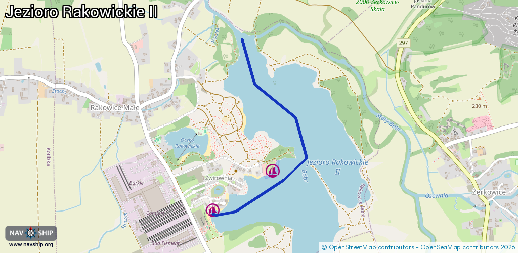
Inland
Driving areas:
🇵🇱 Poland
Length:
1.5 km¹
¹River kilometers or bank length recorded in NavShip, including river arms and harbor entrances.
Availability:
Completely recorded
Recent Update: 03.01.2024²
² This date indicates when an adjustment last took place in the course of the body of water
Recorded:
Locks: 0
Harbours / marinas: 2
Bridges: 0
Berths: 0
Slipways: 0
Fuelstations: 0
Route:
Please wait, loading route graphic...
Request waterway overview map with symbol legend here (Link).
Information about data associated with this body of water (2 available):
Data by OpenSeaMap (c) OSM contributors, www.openseamap.org
| # | Kind | Coordinates | Name | Information |
|---|---|---|---|---|
| 1 | Marina | 51.15414,15.55213 | 2023-06-21T21:19:10Z | Sailing Team [email protected] https://www.facebook.com/StowarzyszenieSailingTeam |
| 2 | Marina | 51.15208,15.54705 | 2023-06-21T21:19:10Z | Czerwony Rak |