Waterway information

Kind:
Inland
Driving areas:
🇵🇱 Poland
Length:
21.9 km¹
¹River kilometers or bank length recorded in NavShip, including river arms and harbor entrances.
Availability:
Completely recorded
Recent Update: 10.10.2023²
² This date indicates when an adjustment last took place in the course of the body of water
Recorded:
Locks: 0
Harbours / marinas: 5
Bridges: 0
Berths: 0
Slipways: 1
Fuelstations: 0
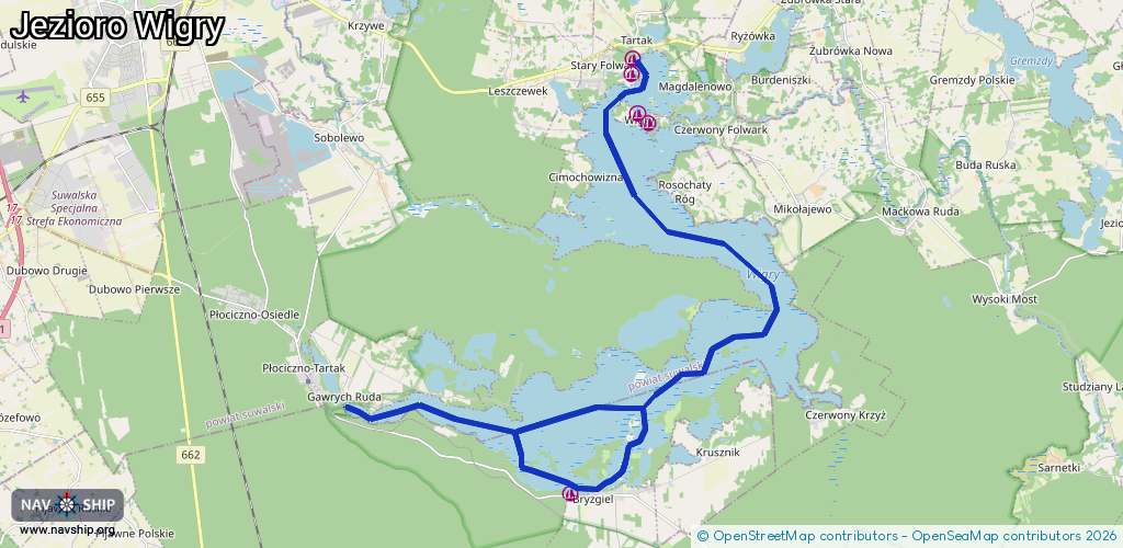
Route:
Please wait, loading route graphic...
Request waterway overview map with symbol legend here (Link).
Information about data associated with this body of water (6 available):
Data by OpenSeaMap (c) OSM contributors, www.openseamap.org
| # | Kind | Coordinates | Name | Information |
|---|---|---|---|---|
| 1 | Marina | 54,23.06518 | 2017-03-03T14:53:34Z | |
| 2 | Marina | 54.06987,23.08621 | 2025-03-16T11:29:30Z | Przystań - statek |
| 3 | Marina | 54.06812,23.08959 | 2021-08-16T04:51:01Z | Marina Wigry |
| 4 | Marina | 54.07714,23.08423 | 2017-03-03T14:53:35Z | |
| 5 | Marina | 54.07996,23.08472 | 2017-03-03T14:53:35Z | |
| 6 | Slipway | 54.00045,23.07356 | small_craft_facility | 2018-01-17T19:59:11Z |